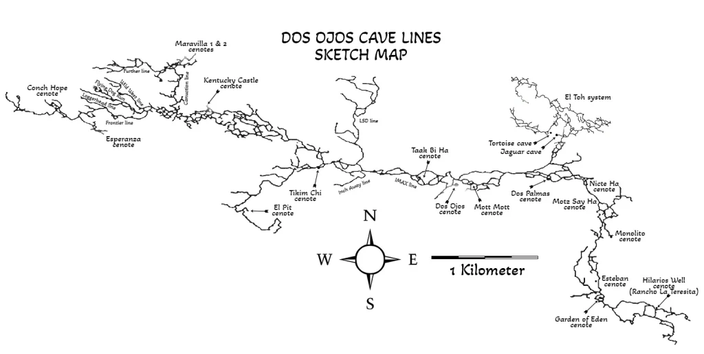
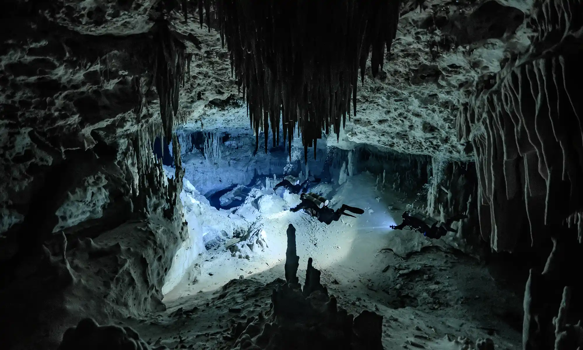
“This cave system is currently listed slightly over 273,294 ft (83,300 m) and has over thirty cenotes within its system as of June 2015. First discovered and explored in 1986 by Jim Coke and Johanna DeGroot, the only way they accessed it was by using a 1954 four-wheel Willis jeep that finally died in 1988. Dos Ojos (means“two eyes” in Spanish) lay dormant until 1992. It was the vision of a newcomer, Buddy Quattlebaum, who recognized the potential of this cave system that lay underneath the property of the Ejido Jacinto Pat.
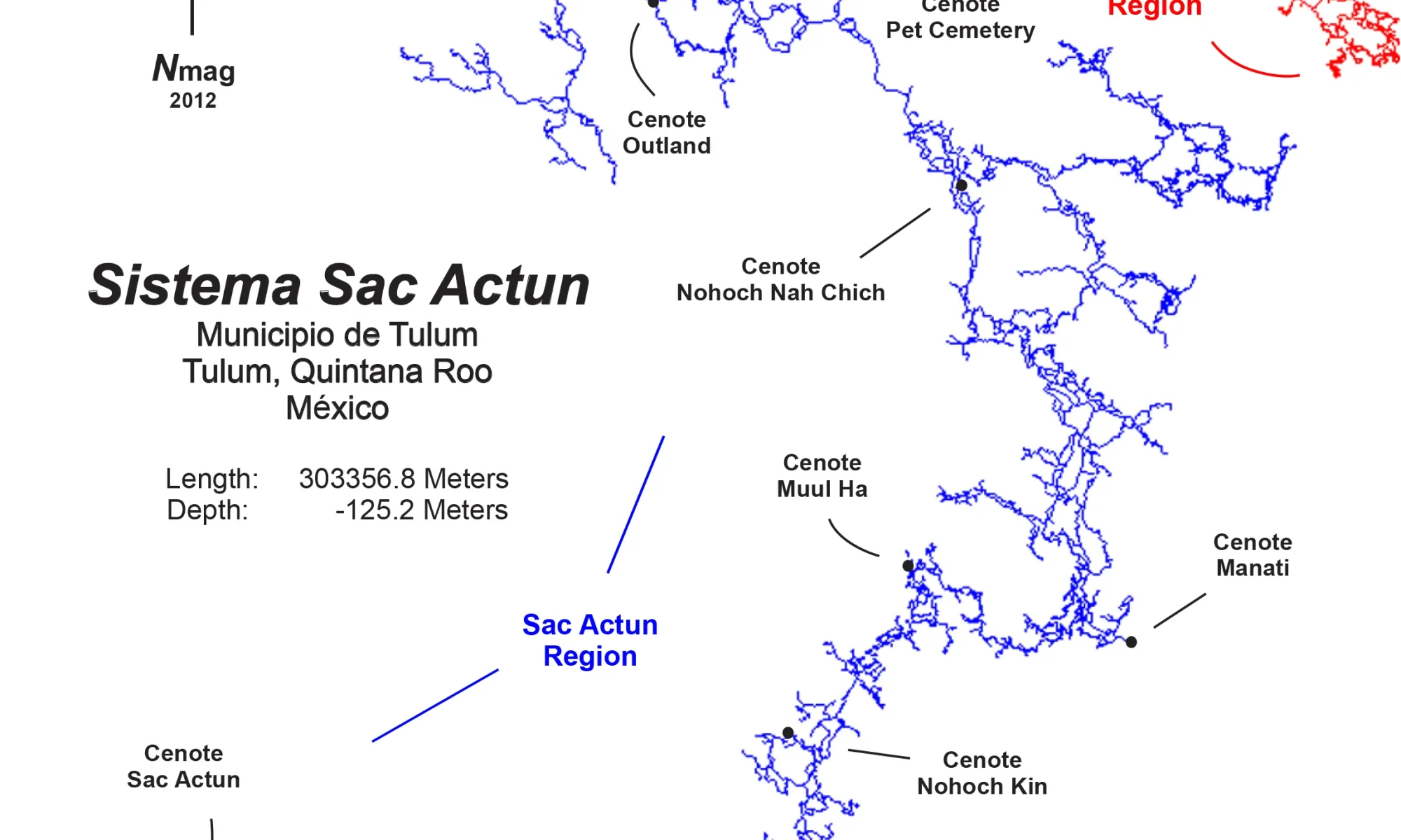
But at the time, an outdated form of Mexican landownership system, the ejido, was in place, and so, Ejido Jacinto Pat was communaly owned by over 180 Mayan families spread over 8,400 hectares of land. Each family owns and works their particular parcel of land. There are several sections that consisted of general-use land governed by the ejido. Quattlebaum and a business partner, Marco Rotzinger, who together owned a dive business, recognized the potential of Cenotes Dos Ojos east and west to be a great place for snorkeling and cavern tours that will attract tourists and will economically benefit the ejido. The ejido agreed to allow a bulldozed trail be improved for vehicle access. This action opened the door for renewed cave exploration. It took off from there, not from an organized expedition format, simply individuals or small groups of individuals adding line here, pushing line there. Slowly but steadily, the cave grew in pieces and chunks. In one four-month span in 1994, Dos Ojos became bigger than Nohoch Nah Chich by 12,000 ft (3,636 m). But Nohoch kept staying ahead with its annual expeditions. At first, no one realized that both cave systems’ passages were found to be gradually becoming closer to each other. Though Dos Ojos never was organized as an expedition, the size, finances, and the logistics were slowly eroding the level of interest of the individuals making contributions to the exploration. Finally, publicity in a technical diving magazine portrayed the two cave systems as competing against each other. To rekindle the interest and trying to create publicity for Dos Ojos and the Ejido Jacinto Pat, a formal, organized expedition was formed during the first six months of 1996 with a two-week grand finale. The directors for the project were the author, Jill Heinerth, and Buddy Quattlebaum. This grand finale involved sixty cave divers and support personnel. It resulted in a total of 71,772 ft (21,749 m) of surveyed passages, including 46,827 ft (14,190 m) of passages, during the two-week grand finale. The expedition was considered a big success with no incidents or mishaps, remarkable for sixty cave divers participating and the challenging logistics that it entailed. Unfortunately, many divers/explorers believed negative publicity by some members of the diving journalistic press depicted the expedition more as a threat than an effort to see a cave grow in size. That image seemed to splinter the cohesive bond of the explorers, and the interest level quickly dropped to nothing on continuing the exploration. Today, Sistema Dos Ojos is opened to any qualified cave diver to explore. All that is asked is submit your survey data to the Ejido Jacinto Pat and the QRSS.
In 1991, it was Hilario Hiler of Akumal, who really cooked up the idea of diving a new cenote he found, which had in it two palm trees, and so he named it Dos Palmas. It was halfway toward Dos Ojos, near the bulldozed trail that now was becoming more useable through the hard work of many members of the Ejido Jacinto Pat. Hiler knew I had organized earlier mini expeditions for cave divers, exploring new cave systems, and that I was thirsty for a new hole to jump in. This Dos Palmas was it!
Still living in Florida, I was staying at Villas DeRosa with my typical week-long trips for cave divers, something I had started back in October of 1986. This group and I were there to explore and not tour. Timing was everything, and this was no exception. In my group were Mike Cameron of Toledo, Ohio; Mark Grant of San Jose, California; and Jim Mellon of Kansas City, Missouri. Also there for that week were Bill Mee and George Irving III of Boca Raton, Florida, who had hired Hilario for the week to find and explore new cenotes. We loaded (should say overloaded) up a DeRosa Dodge van of character with twelve sets of double 80 ft3 tanks. We somehow miraculously got the van all the way to the new power lines and then with hired sherpas to haul all the equipment the remaining 984 ft (300 m) to the cenote. The Mayans built a sturdy ladder, and we got everything down into the cenote. We had two days left in our week. We were originally began that week exploring a cenote on Don Camilo’s land near Cenote Toucha Ha but that proved to be a dead end.

Note: Today Cenote Dos Palmas is privately owned by the Mariano Mazon Can family. They charge one hundred pesos to dive this cenote. The entire cenote basin has been laid out with flat stone and a set of good steps have been put in place for easy entry or exit from the cenote. Very clean, nice bathroom facilities are available. One of the landmark palm trees had died several years ago.
At Cenote Dos Palmas, we successfully pushed our exploration upstream over 1800 ft (548.6 m) and downstream at least 1,200 ft. Little did we know that the River Ride path had begun. At the same time, Buddy Quattlebaum was pushing to another cenote upstream that Hilario had named Cenote High Voltage as it was located right next door to the power lines and a huge tower. He successfully connected with our downstream line that Jim Mellon and I had installed. Wow! Two connects and more beautiful cave for cave divers to dive and sightsee.
The spring of 1992, I returned with another group of cave divers. Buddy was over excited to push a downstream lead he found from the east Dos Ojos cenote, so we agreed to do it together with my group. There with me that time was Steve and Marianne Gamble of Gainesville, Florida, and Mike Cameron again. We decided on a day of the week, Wednesday, loaded up the now famous Buddy mobile and hauled ourselves and the gear to Cenote Dos Ojos. Our theory was simple: connect downstream Dos Ojos to Dos Palmas. Buddy was convinced because of the strong flow of water and the direction it was going that this connection was possible. Well, if you don’t go, you won’t know as I like to say! Off we went with me running the mambo exploration reel, Buddy doing the sniffing, and with everyone following for the fun. This passage was very interesting. It was very obvious that as the cave was once dry; it had water flowing through it, eroding away, a gully giving the obvious appearance of a cave on top of another cave. As the guide reel spun off line as fast as we could swim—gosh, I love that scenario—we pushe this downstream lead. We were about 1,200 ft (367 m) downstream and presto! There was another guideline. Connecting our guideline onto this one. We followed this guideline downstream. We swam 200 ft (61 m), and there was my original arrow marker. This confirmed we were at the point I had ended my original exploration dive months before with Jim Mellon, swimming upstream from Cenote Dos Palmas. Knowing exactly where I was and with everyone having plenty of air, we continued onward to Cenote Dos Palmas. Twenty minutes later, we arrived. What fun! Thus, on this one dive, we made the connection that was over 3,500 ft (1,067 m) in distance and officially blessed it by swimming the traverse. All within safe air rules, no deeper than 34 ft (10.4m) and an average of 22 ft (6.7 m). It does not get any better.
Two months later, Chuck Stevens of X’cacel and Robbie Osman of Oakland, California, pushed the downstream line of Cenote High Voltage and discovered another opening that they named Tapir’s End (Cenote Motz Say Ha) because of a dead wild pig that had fallen in. This cenote’s configuration made it impossible for a two- or four-legged creature to climb out. (Today, there is a wooden platform with steps to enter or exit.) A few weeks later, I returned to the Riviera Maya (August 1992) with my fourth tour cave diving group of that year. On my team were Bob Griffith, Rich Chapski, and Hank Whittenberg, Boston, Massachussetts, and Tim Brewton of Tallahassee, Florida. We jump into Cenote High Voltage with visions of pushing this cave downstream beyond Tapir’s End. That we did. But after 1,700 ft (518 m), it became too small and low for five cave divers to explore. (It as later pushed successfully by Chuck Stevens and Dan Lins.) But on that dive, we did find the official exit for the River Ride with a cenote that Buddy later named Monolito because of a huge rock leaning against the cave opening.
What was created as if a patch quilt was a continuous guideline from the Sistema Dos Ojos east to Cenote Dos Palmas to Cenote High Voltage (Nicte-Ha) to Cenote Tapir’s End to Cenote Monolito. Average swim time is usually 95 to 105 minutes of underwater bottom time. Maximum depth is 34 ft (10.4 m) with an average of 22 ft (6.7 m). You can easily reach each opening within a third of your existing air supply. The flow makes the trip relaxing with little effort. One word of caution, once you start at Dos Ojos, it’s better to commit to going through and not turning around because of the water flow, which we all think is some of the strongest for our area but certainly nothing compared to the high-flow springs of Florida. In addition, this cave is very pretty. The typical decorations, speleothems, and the wizardry of nature at work when the cave was dry fifteen thousand years earlier. A spectacular wonderland! During the past twenty-two years, I say more than four thousand cave divers dived this great traverse cave dive. A must dive for every cave diver who visits the Riviera Maya!”
Excerpt From
The Cenotes of the Riviera Maya 2016
STEVE PENN GERRARD
Back


You do not give credits to all the locals that made that happen. Building the camp. Takeing all the tanks in keeping the the landcruiser going. When it breakdown in the middle of project.. You also forgot the staff of the diveshop and many more situation. You paid 2 shity buck to locals to carry tank on there back. and some of the info you put do not match. You also forgot the the girl who made the map. I was there.
Thank you, Zack, for the comment! Appreciated! I would be happy to add relevant credits if you share the details with me.
My wife and I met Buddy in 1986 in Xcacel. We were staying at Pink Flamingo in Akumel (place of the turtle) on half moon bay. We met a family from Calif at the pool. He told us if we wanted to see turtles we should go 5 klicks south to Xcacel and meet Buddy. We did. There was only a Cantina and camping ground, and Buddy and his mother living in a trailer. They had dug imprints in the sand and pumped sea water to them. There were two imprints.
We met Buddy at the Cantina, shirtless, barefoot, and tanned. When we explained our interest in turtles he directed us to the indents.
The first one approx 15 ft by 10 ft (?) Had baby turtles, maybe one week old, 30 or 40 of them. The second had the same amount of turtles, but they were about six or seven weeks . He explained they were ready to be released as they now had 100 fewer dangers in the ocean.
He directed us to return to Xcacel that evening and find Julio. Who worked for the government
Counting turtles.
We returned 9 pm that night and met Julio. He took us to the very south end of the beach to the turtle hatchery. (There was a sunken wreck just offshore) It was fenced off with about 20 or more turtle nests. There was one nest that had a wire around it and there was two baby turtles scratching at the wire. He directed us to the next beach south (Xcacalito) and his crew. These men had found a fresh nest that was breaching the sand. They were taking the hatchlings and counting them, then to be released to the Mexican Gulf. As we watched the crew counted over eighty turtles, then handed us the bucket and told us to release the newborns to the water. Of eighty two were still born. The turtles swam immediately into the ocean and apparently to the sargasso sea.
We all returned to the hatchlings at the point and the nest the had two newborns now had 30 or more hatchling crawling all over each other.
The crew counted the hatchlings and put them in a bucket. They then gave us the bucket and instructed us to set them free. They told us to go some distance down the beach as they had released turtle babies earlier at this spot.
Went scuba diving off Akumel with Buddy.
Saw school of 10 foot marlin(?) Later went cave diving with Buddy (cenote-bats).
Did dos Ohos in the 90’s .
Incredible story, James! Thanks for sharing! It was a real frontier in those days.