This Dos Ojos exploration story is a retelling, not a reprint. It follows one chapter of Steve Gerrard’s 2016 edition of The Cenotes of the Riviera Maya. The dates, distances, and names are his. The wording is ours, so read the book for the full first-hand account.
Dos Ojos exploration: the first years
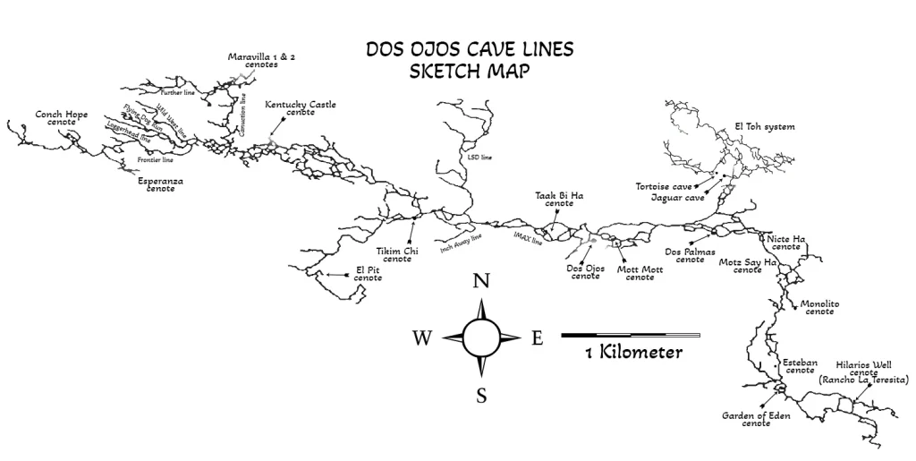
Jim Coke and Johanna DeGroot found Sistema Dos Ojos in 1986 and ran the first dives. Their only way in was a 1954 Willys jeep, until the jeep died in 1988. After that, the cave sat untouched until 1992. As of June 2015, the system stood at just over 83 km (273,294 ft) with more than thirty cenotes.
The name means two eyes in Spanish. The cave lay under the land of the Ejido Jacinto Pat. Buddy Quattlebaum, a newcomer at the time, saw what it could become. However, the ejido was an old communal form of land ownership. More than 180 Maya families owned the 8,400 hectares together, and each family worked its own parcel. Some sections stayed in general use under the ejido’s control.
Quattlebaum and his business partner Marco Rotzinger ran a dive operation. They saw income for the ejido in snorkel and cavern tours at the two Dos Ojos cenotes, east and west. So the ejido agreed to improve a bulldozed trail for vehicles, and that trail reopened the cave to divers.
Nobody ran the Dos Ojos exploration as a project in those years. Individuals and small teams added line here and pushed a lead there. Slowly but steadily the cave grew in pieces. In one four-month stretch in 1994, it passed Nohoch Nah Chich by 3,636 m (12,000 ft). Nohoch answered with its annual expeditions and stayed ahead. Meanwhile, the two systems were creeping toward each other, and at first nobody noticed.
The 1996 project and its aftermath
Size, money, and logistics slowly wore down the volunteers. Then a technical diving magazine framed Dos Ojos and Nohoch as rivals. To restart the Dos Ojos exploration and to draw attention to the ejido, the explorers set up a formal project. It ran through the first half of 1996 with a two-week grand finale. Gerrard, Jill Heinerth and Buddy Quattlebaum directed it.
The finale brought together sixty cave divers and support personnel. In total, the project surveyed 21,749 m (71,772 ft) of passage. Of that, 14,190 m (46,827 ft) came during the two-week finale. Nobody got hurt, and nothing went wrong. Gerrard calls that remarkable, because the logistics for sixty divers were anything but simple.
The press reaction, however, cut the other way. Some diving journalists described the project as a threat to the cave rather than an effort to map it. Many explorers took that badly; the group lost its cohesion, and interest in pushing Dos Ojos dropped to nothing. Today the Dos Ojos exploration is open to any qualified cave diver. The only request is to submit your survey data to the Ejido Jacinto Pat and to the QRSS.
Dos Palmas, 1991
In 1991, Hilario Hiler of Akumal found a cenote roughly halfway toward Dos Ojos, near the bulldozed trail. Two palm trees stood in it, so he named it Dos Palmas. Hiler knew that Gerrard had run small exploration trips before and wanted a new hole to jump into. This was it.
Gerrard still lived in Florida then. Since October 1986 he had run week-long trips for cave divers out of Villas DeRosa. That week his group came to explore, not to tour. With him were Mike Cameron of Toledo, Mark Grant of San Jose and Jim Mellon of Kansas City. Bill Mee and George Irving III of Boca Raton were also there. They had hired Hilario for the week to find and explore new cenotes.
They loaded, or rather overloaded, a DeRosa Dodge van with twelve sets of double 80s. Somehow the van still made it to the new power lines. From there hired porters carried the gear the last 300 m (984 ft) to the cenote. The Maya built a sturdy ladder, and everything went down into the water. Two days of the week remained. The earlier days had gone to a cenote on Don Camilo’s land near Toucha Ha. That one proved a dead end.
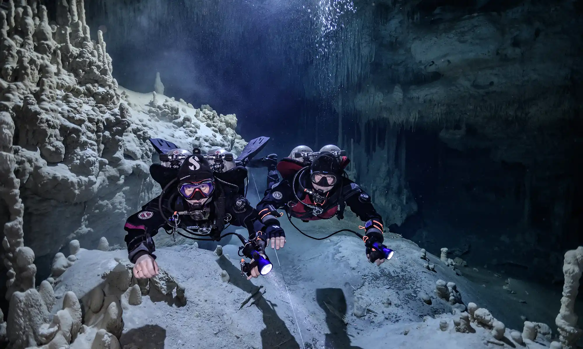
At Dos Palmas, they pushed upstream for more than 548 m (1,800 ft). Downstream they added at least 366 m (1,200 ft). Unbeknownst to them, they had opened the River Ride branch of the Dos Ojos exploration.
High Voltage and the first connections
At the same time, Buddy Quattlebaum was pushing from a cenote further upstream. Hilario had named it High Voltage after the power lines and the tower next to it. Buddy connected into the downstream line that Gerrard and Jim Mellon had laid. Two connections, and the Dos Ojos exploration gained much more cave to dive and explore.
A note from the book: by 2016 Cenote Dos Palmas was in private hands. The owners had paved the basin with flat stone and built good steps. Meanwhile, one of the two landmark palms had died.
The connection dive, spring 1992
In spring 1992, Gerrard came back with another group: Steve and Marianne Gamble of Gainesville, and Mike Cameron again. Buddy had found a downstream lead from the east Dos Ojos cenote and wanted to push it with them. He read the strong flow and its direction as proof that the link existed. So the plan was simple: link downstream Dos Ojos to Dos Palmas. They picked a Wednesday, loaded the Buddy mobile, and drove to Dos Ojos.
Gerrard ran the exploration reel, Buddy sniffed out the way, and the rest followed for fun. The passage looked like a cave on top of a cave. Water had cut a gully through the floor when the cave was dry. The reel spun off line as fast as they could swim. Then, about 366 m (1,200 ft) downstream, another guideline appeared.
They tied in and followed it downstream. After 61 m (200 ft) Gerrard found his own arrow. It marked the end of his Dos Palmas dive with Jim Mellon months earlier. Everyone had plenty of air, so they carried on and surfaced at Dos Palmas twenty minutes later. One dive had closed a gap of more than 1,067 m (3,500 ft). The team then swam the whole traverse to make it official. The route stayed within air rules: maximum depth 10.4 m (34 ft), average 6.7 m (22 ft).
Tapir’s End and Monolito
Two months later, Chuck Stevens of X’cacel and Robbie Osman of Oakland pushed the downstream line from High Voltage. They came up in a new opening and named it Tapir’s End, or Cenote Motz Say Ha. A dead wild pig had fallen in earlier, giving the place its name. The shape of the cenote lets nothing on two or four legs climb out. Today a wooden platform with steps solves that for divers.
In August 1992, Gerrard was back with his fourth group of the year. With him were Bob Griffith, Rich Chapski and Hank Whittenberg of Boston, and Tim Brewton of Tallahassee. They dropped into High Voltage to push beyond Tapir’s End. The push worked until, after 518 m (1,700 ft), the passage became too small and too low for five divers. Chuck Stevens and Dan Lins later pushed it further. On that same dive the team found the official exit of the River Ride. Buddy later named that cenote Monolito, for the huge rock leaning against its opening.
The River Ride traverse
What grew like a patchwork quilt is now one continuous guideline. It runs from the east Dos Ojos cenote to Dos Palmas, then on to High Voltage (Nicte-Ha). From there it continues to Tapir’s End and exits at Monolito. Gerrard gives the swim as 95 to 105 minutes of bottom time. The maximum depth is 10.4 m (34 ft), and the average is 6.7 m (22 ft). Each opening sits within a third of your air supply, so the plan stays simple. Besides, the flow does most of the work, and the swim takes little effort.
One caution from the book. Once you start at Dos Ojos, commit to the whole traverse rather than turning around. The flow here is among the strongest in the area, though it is still nothing like the Florida springs. The cave is also decorated along the entire route. Speleothems from the dry period, some fifteen thousand years ago, line the passage. By Gerrard’s count, more than four thousand cave divers swam the traverse in the twenty-two years before the book.
Dos Ojos exploration after the book
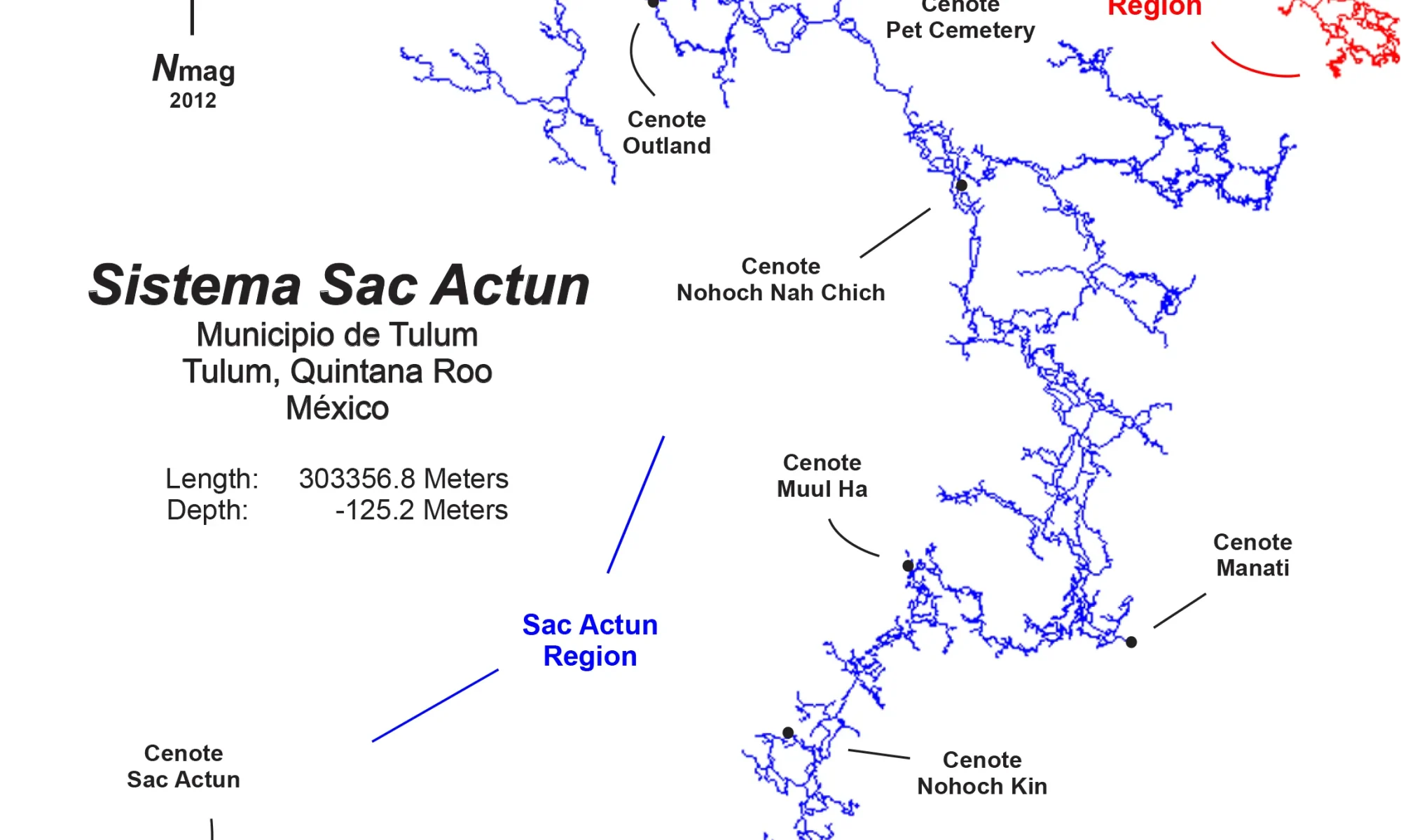
The Dos Ojos exploration did not stop in 1996, and it did not stop with Gerrard’s book either. Later, in 2018, divers linked Sistema Dos Ojos to Sistema Sac Actun. The QRSS now carries the combined system at about 379.6 km. Its news page also reports a team resurveying and mapping the Dos Palmas area. Those are the passages where Gerrard’s groups laid the first line. Any survey data from a qualified cave diver still goes to the QRSS, as Gerrard asked.
We dive the Dos Ojos side of this system on most course and guiding weeks. The River Ride is a full cave dive, not a cavern tour, so cave certification is the entry ticket. Write to us if you want to swim the traverse with a Cave Ha guide. Likewise, write to us if you plan to add your own survey line to the Dos Ojos exploration.
Back
You do not give credits to all the locals that made that happen. Building the camp. Takeing all the tanks in keeping the the landcruiser going. When it breakdown in the middle of project.. You also forgot the staff of the diveshop and many more situation. You paid 2 shity buck to locals to carry tank on there back. and some of the info you put do not match. You also forgot the the girl who made the map. I was there.