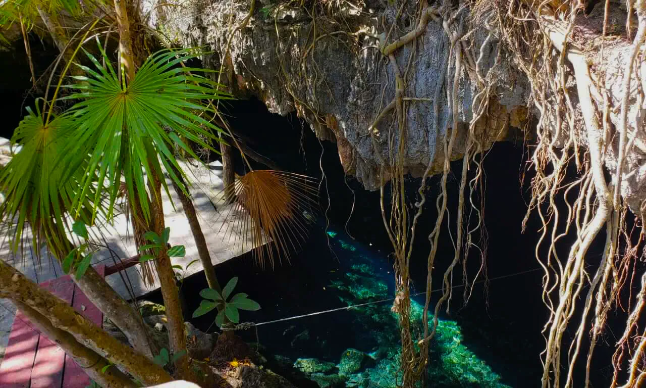
Dos Palmas Cenote is one of the most stunning cenotes in the Dos Ojos cave system. The entrance to this famous cenote is located approximately 48 km south of Playa del Carmen. A 2.5 km dirt road leads from the highway to the cenote and parking.
The name “Dos Palmas” means “two palm trees”. It originated for the two palmas growing near cenote entrance. Few years ago one plam tree was died.
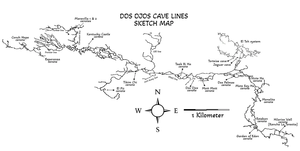
Dos Palmas Cenote is part of the Dos Ojos cave system of the same name. Connected system Sistema Sac Actun-Nohoch-Dos Ojos today is the world’s second-largest underwater cave system, 376,7 km (234 miles) of underwater lines, with a maximum depth of 119.18 mts (391 ft). Dos Ojos section is an anchialine cave system connecting to naturally intruding marine water and tidal influence in the cenotes. This cave system’s coastal discharge point(s) has not yet been humanly explored through to the ocean. Large volumes of groundwater were demonstrated by dye tracing to flow towards Caleta Xel-Ha, a nearby coastal bedrock lagoon.
The history of the Dos Palmas exploration project can be read in our article Sistema Dos Ojos Exploration Project.
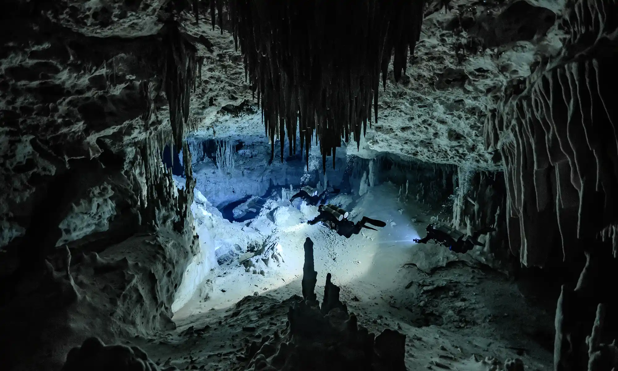
Known for its shallow dives, Dos Palmas offers cave divers plenty of time to enjoy the beautifully decorated system. Four permanent lines can be explored directly from the Dos Palmas entrance platform. The most visited are the upstream and downstream lines. Dos Palmas cave lines suit beginners Intro to Cave (GUE Cave 1) divers who want to grow their experience before continuing to the Full Cave (GUE Cave 2) pass.
For your convenience, an equipment table is available where you can park next to the wood deck in the cenote. Walk down a flight of seventeen steps. There is a wooden deck platform with steps provided. You’ll also find bathroom facilities located behind the restaurant.
Our Dos Palmas Cenote cave diving video

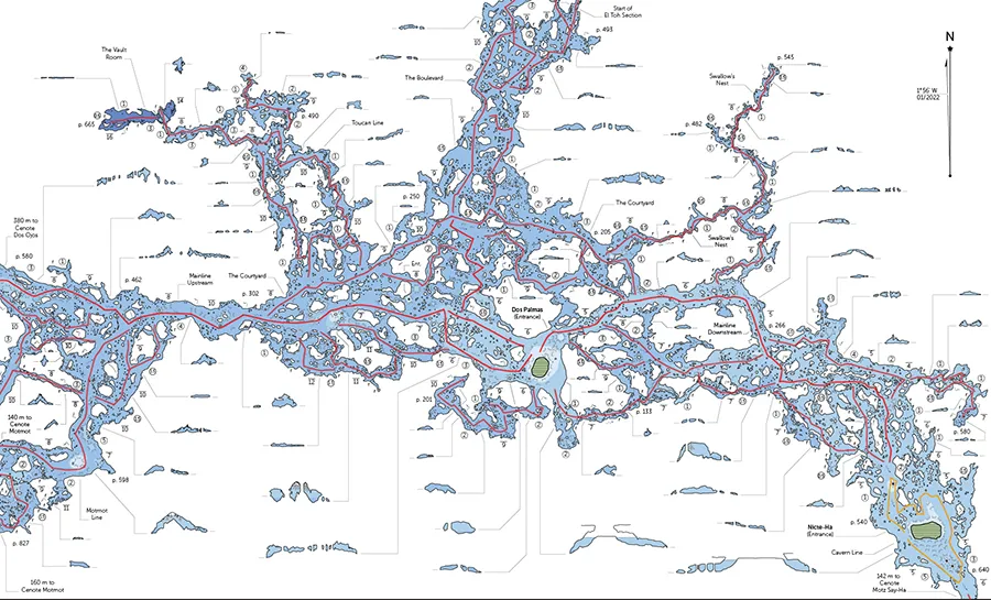
Dos Palmas Cenote cave lines map
Upstream and Downstream lines
The maximum depth of this cenote area is 34 ft (10.4 m). It is a 3,500 ft (1,067 m) swim upstream (against flow) to Cenote Dos Ojos or a twenty-eight-minute swim downstream to Cenote Nicte Ha (High Voltage).
Dos Palmas Cenote location map
The first explorers were Steve Gerrard, Mark Grant, George Irvine, and Bill Mee in September 1992. Other explorers were Gary Walten, and others were unknown.
Back