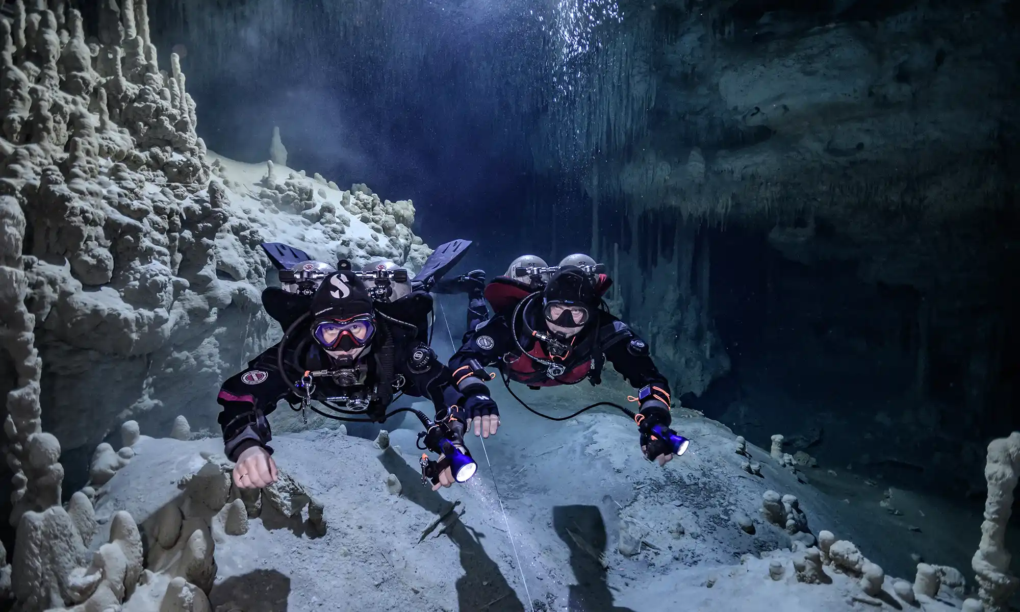
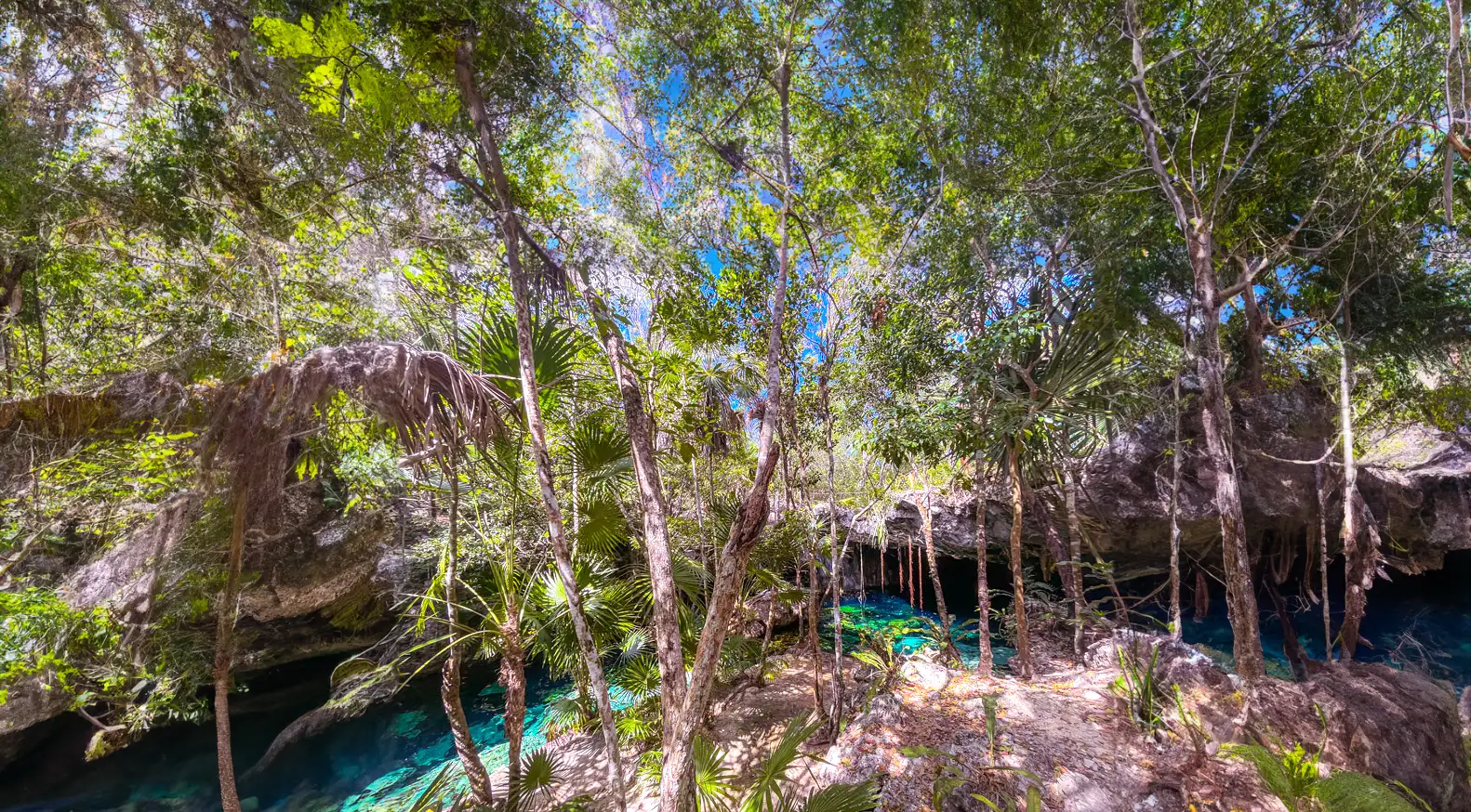
Robbie Schmittner considers the Dos Pisos Cenote cave system one of the most beautiful in the Riviera Maya.
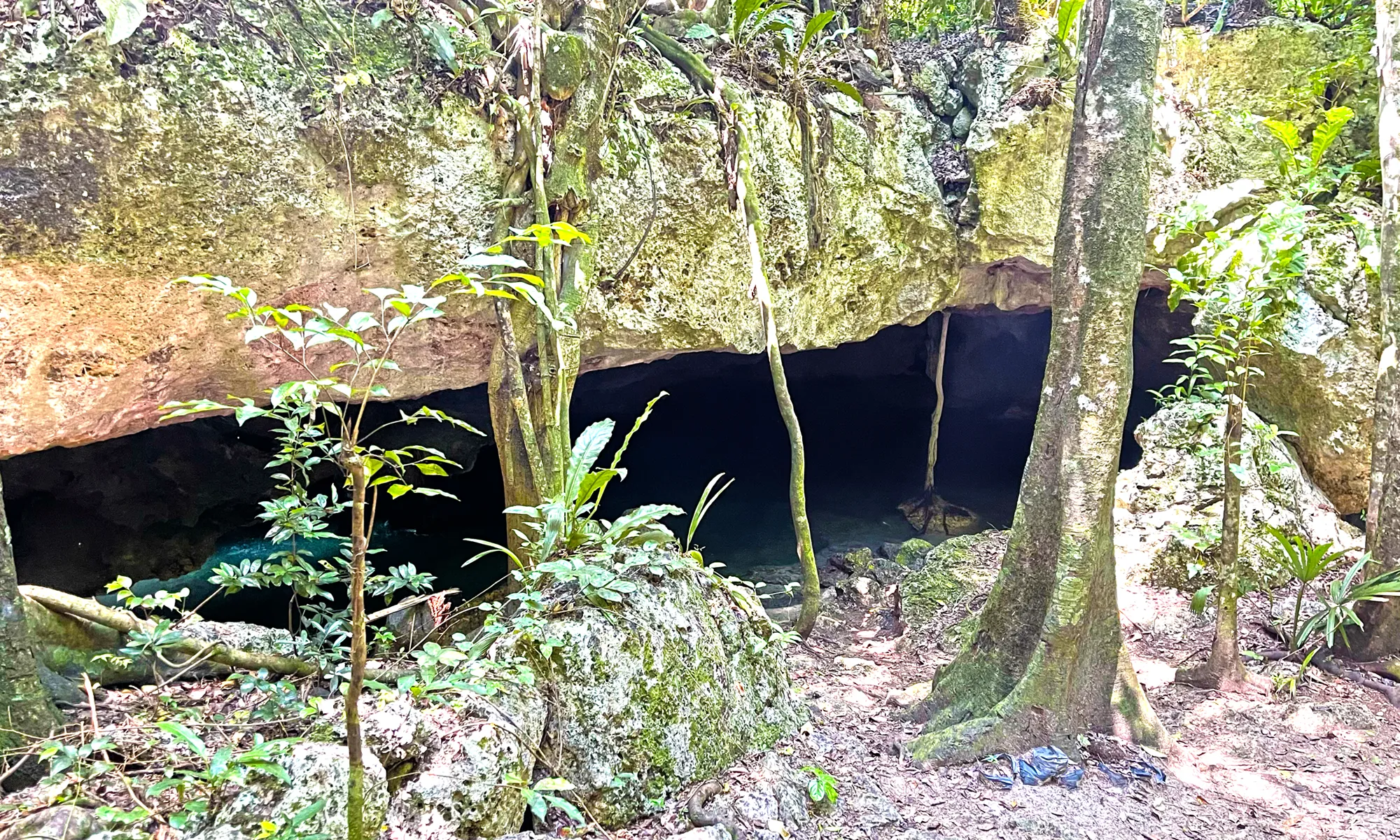
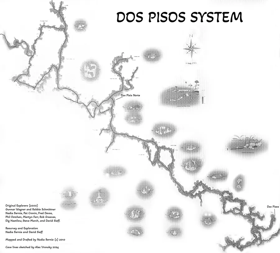
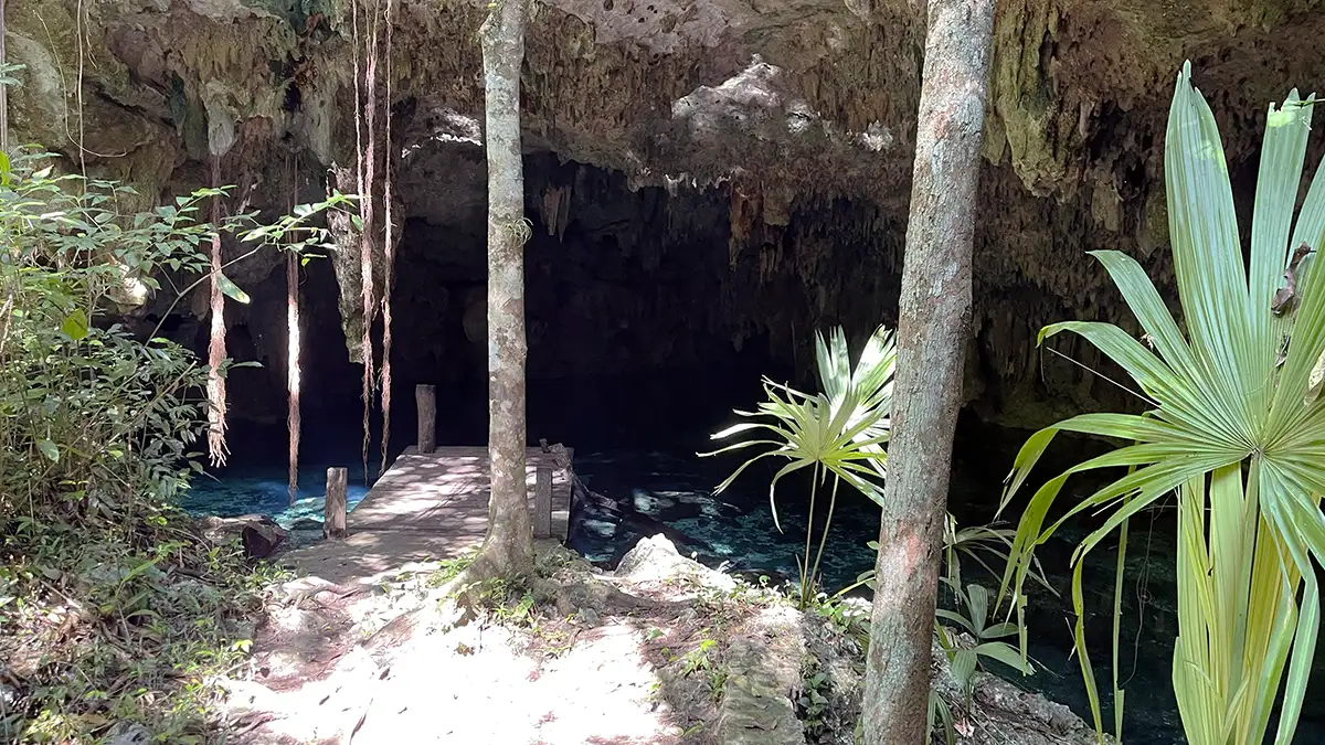
Dos Pisos Cenote is the main entrance to the eponymous cave system. This cave system, spanning a linear distance of 46,509 ft (14,176 m) and reaching a maximum depth of 80 ft (24.4 m), is a unique marvel. It has five distinct cenotes: Cenote Balam, Dos Pisos Norte, Dos Pisos, Cenote Monkey Dust, and Cenote Zooz.
The permanent line begins out of water. You will swim approximately 200 ft (60.1 m) of small and silty passage. However, as you swim further in, it will get bigger and bigger. Anywhere in the cave is extremely beautiful. The cave system averages about 20 ft (6.1 m). The sediments vary from fine light brown silt to black organic mung. The cave is incredibly decorated with white speleothems of all descriptions.
This section traverses Cenote Dos Pisos to Dos Pisos Norte (take right on the T-intersection). Once you reach the left at the T, you head toward the part of the system related to Monkey Dust Cenote.
There are two equipment tables for use. There are no bathrooms available.
Dos Pisos Cenote cave lines map
Dos Pisos Cenote cave lines map
Dos Pisos Cenote location map
Gunnar Wagner and Robbie Schmittner were the first pioneers to explore this magnificent cave system. They were followed by a group of intrepid explorers, including Nadia Bernie, Pat Cronin, Fred Devos, Phil Dotchen, Martyn Farr, Rob Greaves, Dig Hastilow, Steve March, and David Sieff.
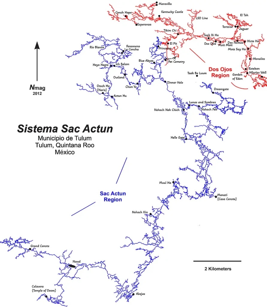
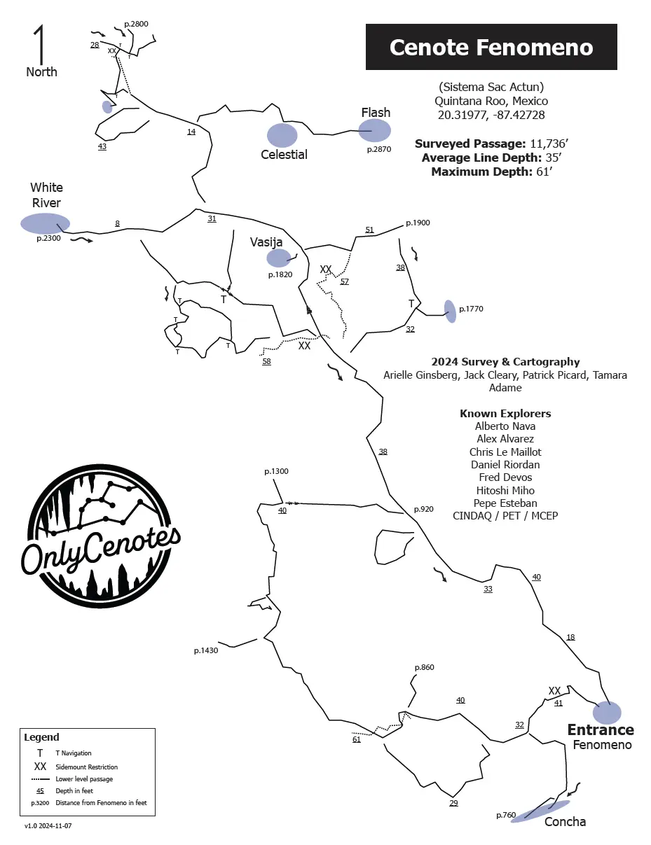
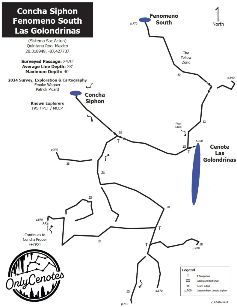
The Pedrin Fenomeno Cenote is part of the huge underwater cave system Sac Actun—Dos Ojos—Nohoch Nah Chich.
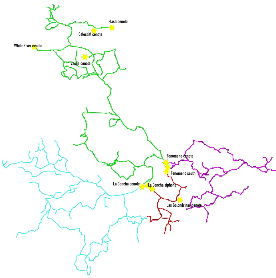
Turning toward Pedrin Fenomeno Cenote into the jungle on the 54th kilometer from Playa del Carmen of the Cancun-Tulum federal road, you will find yourself on a country road. Following, the dusty, bumpy road leads deep into the jungle. It connects the entrances to a multitude of beautiful cenotes. Caracol, Chun Ya, Otoch Ha, Outland, La Concha, Pedrin Fenomeno, etc.
Cenote Pedrin Fenomeno is part of the connected system Sac Actun-Nohoch-Dos Ojos. Moreover, it is the world’s second-largest underwater cave system, with 376,7 km (234 miles) of underwater lines. The maximum depth is 119.18 mts (391 ft). The Nohoch historical section is an anchialine cave system connecting to naturally intruding marine water and tidal influence in the cenotes. However, this cave system’s coastal discharge point(s) has not yet been explored into the ocean. Despite this, dye tracing to flow towards Caleta Xel-Ha, a nearby coastal bedrock lagoon, demonstrated large volumes of groundwater.
Sac Actun-Nohoch-Dos Ojos Cave lines with cenotes name General Map
The next world’s longest cave system, Ox Bel Ha, is very close — just a few kilometers south. So, perhaps shortly, a place will be discovered where these two cave systems connect. The combined cave system will be the largest underwater cave system in the world and the largest cave system in general, including dry caves.
Farther away in the forest, an 8km potholed dirt road leads to the Pedrin Fenomeno Cenote. Pedrin Fenomeno is one more half-collapsed sinkhole. Together with other nearby cenotes, it was part of the Actun Hu (don’t mess with Actun Ha) cave system, which now belongs to the Sac Actun-Nohoch-Dos Ojos cave system. Furthermore, the jungle atmosphere was overwhelming. There is a dilapidated bridge to enter the water. The stairs have collapsed, but you can enter the water on the right or left along the shore. You will come to a shady pond about 2-3 meters (6-10 feet) deep. Outside the cave were tall leafy trees, and beautiful “mot-mot” birds flew by.
The main line is just behind the rock, leading inside half-open cenote waters. After passing through several beautiful halls, the permanent line descends to 10 meters and remains at this depth until an unnamed cenote on the left, 600 meters (1800 feet) from the entrance. Visibility is always clear. You can jump left toward La Concha Cenote or continue straight forward.
On the way inside, you can discover an ancient vase on the left and megatherium (giant sloth) bones in a 17-meter (56 ft) deep pit on the right. At about 1200 meters distance from Cenote Pedrin Fenomeno entrance, you will arrive at the beautiful blue-colored waters of the White River Cenote, which you can pass forward following the line toward various T-intersections or jump to the right to the neighbor line leading to one more unnamed cenote in 1600 meters (1 mile) from the entrance.
The first explorers were PET members Alex Alvarez, Franco Attolini, and Alberto Nava, who joined forces with MCEP/CINDAQ members Chris Le Maillot, Daniel Riordan, Fred Devos, and Sam Meacham to explore the Aktun Hu Cave System.
Explorations in Sistema Actun Hu began in January 2007. Explorers focused on La Concha, Pedrin Fenomeno, and upstream Cenote Chicomoztoc. About 8,000 ft (2,438 m) of passages were explored and surveyed, and a new, large cenote was located southeast of La Concha.
Robbie Schmittner connected Sistema Aktun Hu to the Nohoch Nah Chich region of Sistema Sac Actun on January 30, 2011
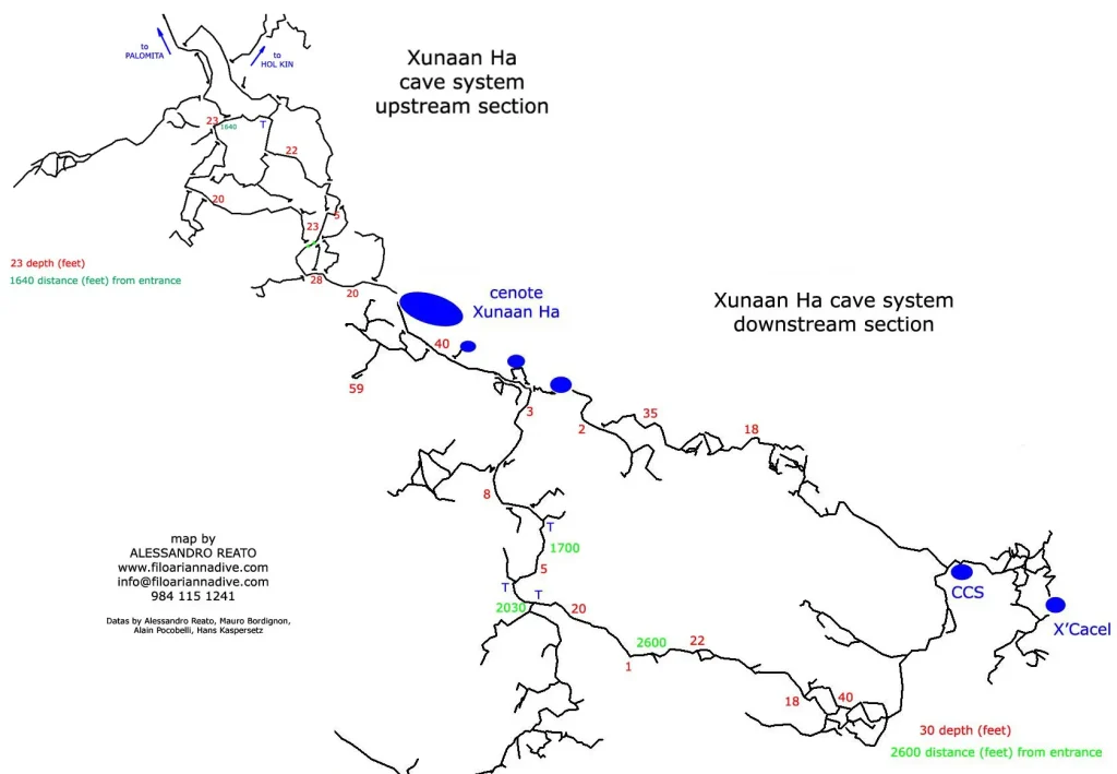
Xunaan Ha Cenote is part of the eponymous cave system, the world’s 7th longest underwater system (4th biggest in Mexico), with a total length of surveyed lines of 52214 meters (32.44 ml). The maximum depth within this cave system is 27.1 m (89 ft).
There are thirty-one cenotes within this cave system. They are Cenote Abismo, Cenote Boy, Cenote Chango, Cenote Chemuyil Sur, Cenote Hol Kin, Cenote Jaguar House, Cenote Murcielago’s House, Cenote Renzo, Cenote Palomita, Cenote Pitch, Cenote Powerline, Cenote Principal, Cenote Rojo, Cenote Small, Cenote Xunaan Ha, plus sixteen more.
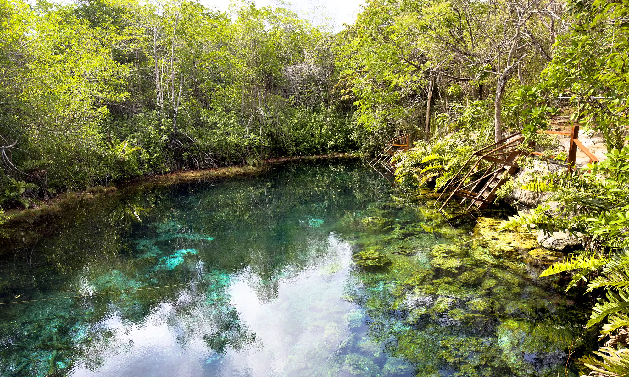
Cenote Xunaan Ha offers excellent cave diving, snorkeling, and swimming options in the main pond.
The main upstream and downstream lines are under the jump platforms left from the ladders. This cave system has various features for cave diving using both backmount and sidemount configurations.
Xunaan Ha cave system upstream and downstream lines map
Xunaan Ha up-n-downstream sections cave map by Alessandro Reato
Xunaan Ha Cenote location map
The first explorer was Mike Madden. Other explorers were Philippe Brunet, Bruno Bonacosso, Mauro Bordiognon, Pierre Boudinet, Philipe Cabrejos, Gilles Carmine, Christian Cluade, Bruno Delprat, Christain Depin, Anne Dutheillet, Christian Edsel, the author, Bernard Glon, Paul Heinerth, Philippe Imbert, Marike Jasper, Tony Lacclete, Pedro Lage, Hans Kaspersetz, Kate Lewis, Connie LoRe, Joao Neves, Bojano Ostovijic, Alain Pocobelli, Bil Philips, Alessandro Reato, Ricardo, Simon and Donna Richards, Edsel De Los Rios, Marco Rotzinger, Robbie Schmittner, Manual Soares, Christian Thomas, Evgeni Voidakov, and German Yanez.
From 2009 to 2012, Mauro Bordignon, Alain Pocobelli, and Alessandro Reato organized and conducted a complete survey and further exploration of the Xunaan Ha Cenote cave system. For detailed information, please go to the website www.filoariannadive.com.
Alessandro Reato has drawn a beautiful cartography map of the Hol Kin section of the Xunaan Ha Cave System.
Minotauro is a smallish cave system that suits a two—to three-person dive team. The maximum depth is 58 ft (17.7 m). There are five cenotes located within this cave system: Cenote Minotauro (main entrance), Cenote Escalera (Stairs), Cenote Estrella (Stars), Cenote Piedra (Stone), Cenote Winz, and one unnamed cenote entrance.
The upstream main line involves a very enjoyable circuit dive called La Vuelta (the Turn).
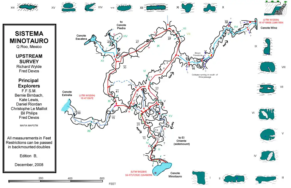
Minotauro Cave System upstream area lines map
Minotauro upstream area cave lines map
The downstream area of this cave system is excellent for side-mount diving. It became trendy for sidemount cave diving training a few years ago, but now any training dives here are prohibited.
A cleared road with sascab dirt laid down allows cars and vans to drive 1.5 km to the cenote. The entrance is easy to access, with beautiful cement, safe stairs, and a walkway to the water. Equipment tables are available, and there is plenty of parking for vehicles. There are bathroom facilities.
To the northwest of the Minotauro system is the Tajma Ha cave system. Water from this system feeds into the Sistema Minotauro, located further east and within 200 ft (61 m). Various cave divers have made unsuccessful attempts to connect the two cave systems. A severely collapsed area blocks, so far, any union, though water samples have proven it is the same water.
Minotauro full lines map
Minotauro Cave System lines map
Cave map drawing of the Munotauro system
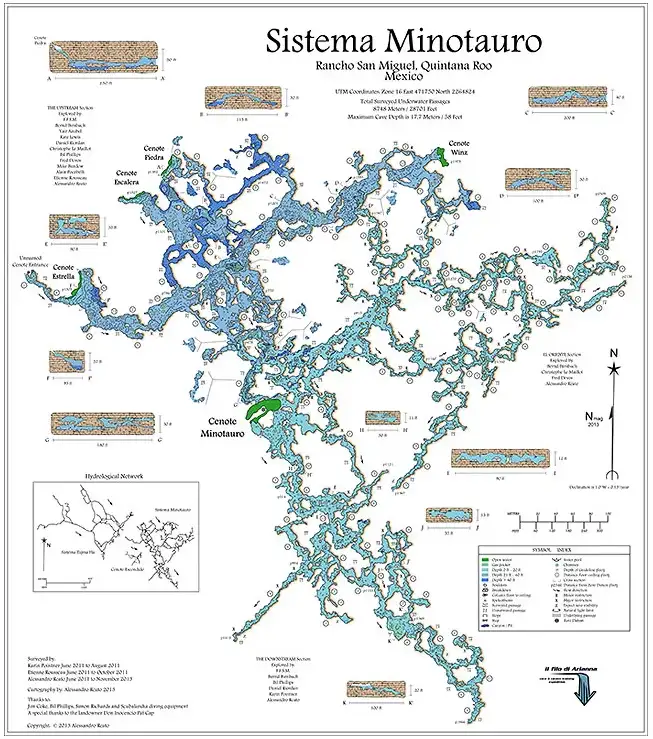
Minotauro Cave System map by Alessandro Reato.
This beautiful cave map drawing was published courtesy of Alessandro Reato. For 43 USD, you can buy this card from us in 60 x 72 cm size.
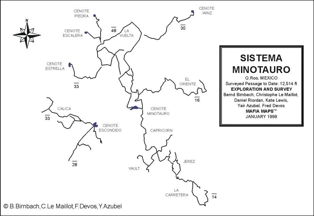
Minitauro Cenote location map
Bernard Glon, Joao Neves, Laura Neves, and Christian Thomas were the first explorers of this cave system, paving the way for further exploration.
They were followed by a dedicated group of adventurers, including Yair Azubel, Bil Philips, Bernd Birnbach, Fred Devos, Christophe Le Maillot, Kate Lewis, Karin Pointner, Alessandro Reato, and Danny Riordan.
