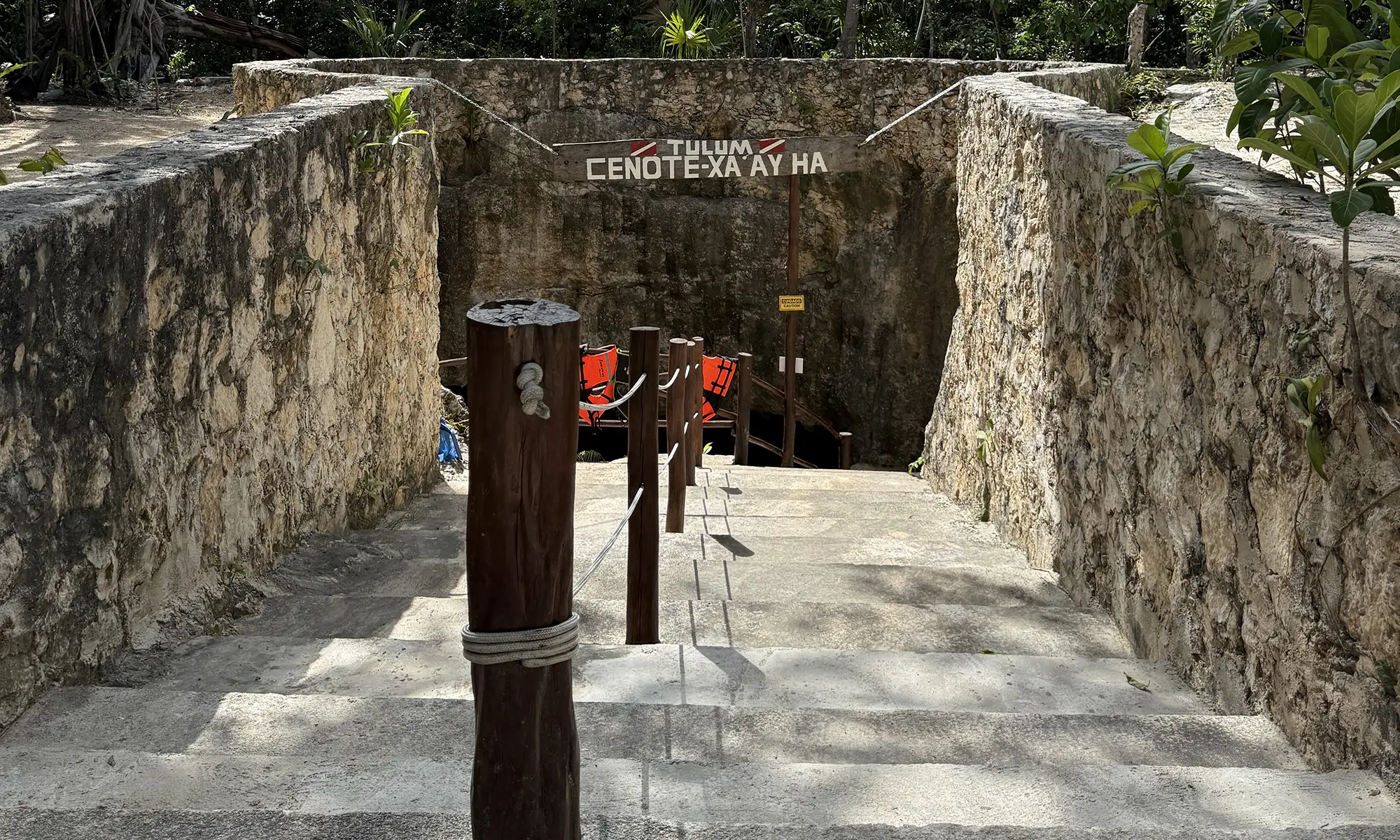
Cenote Xa’ay Ha, also known as cenote Chi Keen, is located 4.5 km southwest of Tulum. It is situated just past the turnoffs for Dos Pisos and Monkey Dust cenotes.
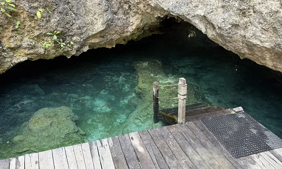
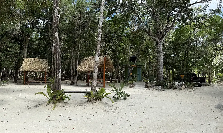
A short walk along a well-maintained rock stairway leads you to a wooden ladder and a platform for gear setup at the water’s edge. This setup provides easy access to Xa’ay Ha Cenote.
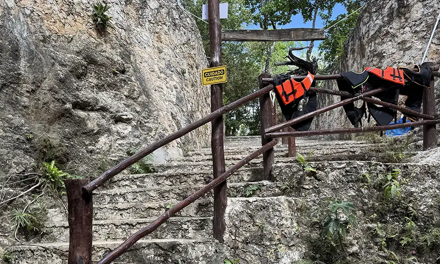
The site is clean and well-organized, with parking, tables, and restrooms available on-site. This makes it a convenient visit to Xa’ay Ha.
Cenote facilities
A detailed map of the cave lines is posted at the entrance. It guides visitors through the Xa’ay Ha Cenote cave lines.
Xa’ay Ha (Chi Keen) Cenote cave lines map
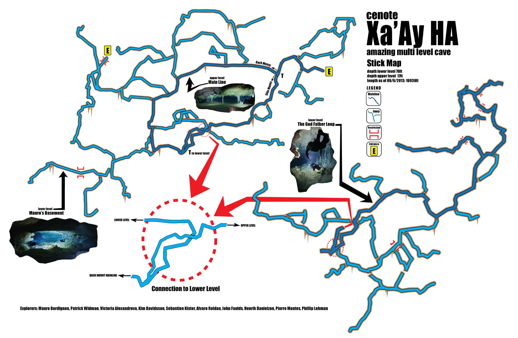
The cave map was published on the Xa’ay Ha (Chi Keen) Cenote fan club’s Facebook page.
The total length of this cave system, as explored and surveyed, is 4,992 meters (16,377 feet). The maximum depth is 21 meters (70 feet), and the system contains three cenotes linked to Xa’ay Ha.
Cave lines directions
The main cave line begins in the right-hand tunnel, just past the first turn. It offers an intriguing starting point for exploring the Xa’ay Ha Cenote cave system.
Shortly after entering, you’ll reach a T-intersection. Taking the T-right route leads you on a longer path, suitable for backmount divers, that eventually connects to the next T-intersection. On the other hand, the T-left path is shorter and better suited for sidemount divers. It includes 2 restrictions along the way.
The right-hand route offers multiple beautiful side lines worth exploring.
Both the left and right routes eventually meet and bring you to another T-intersection. From there, you can either loop back to the first T or follow the middle line leading downward. This path lets you enter the second, deeper level of the Xa’ay Ha (Chi Keen) cave.
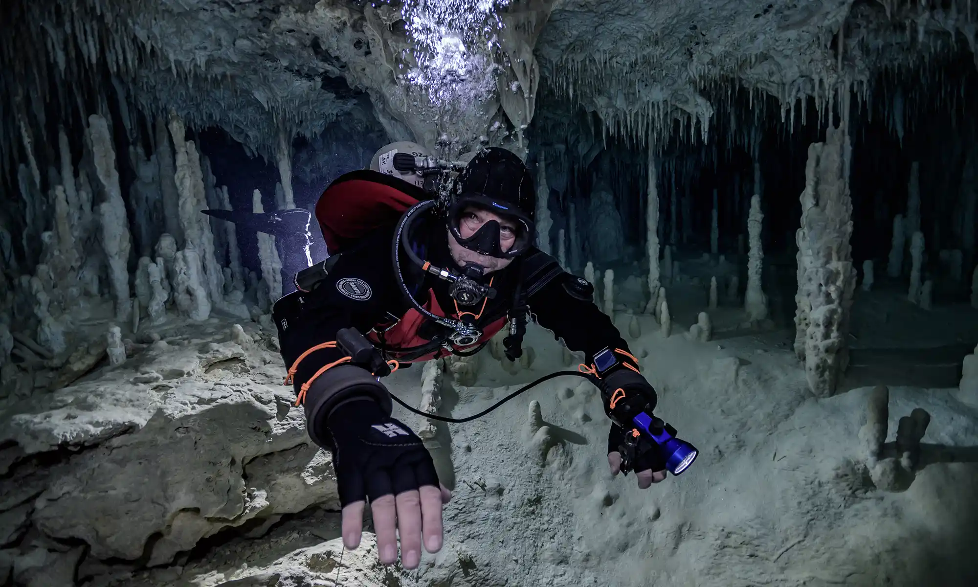
This lower level is richly decorated with stunning cave formations. Following the main line allows you to enjoy the scenery as well as explore several side passages typical of the Xa’ay Ha system.
The average depth of the upper level is approximately 5 meters (17 feet). In contrast, the guideline on the lower level is around 12 meters (40 feet).
Xa’ay Ha (Chi Keen) cenote location map
The known explorers of the Xa’ay Ha (Chi Keen) system include Mauro Bordignon, Patrick Widman, Victoria Alexandrova, Kim Davidsson, Sebastien Kister, Alvaro Roldan, John Faulds, Henrik Danielzon, Pierre Montes, and Phillip Lehman.
Back
Wow, this is just the *perfect* reminder that getting lost in a Yucatan cave isnt just theoretical! 😅 The T-intersections sound fantastic for a good old-fashioned cave diving Where did I park my reel? moment. And 17 feet of average depth on the lower level? Roughly the depth of my enthusiasm for math homework… underwater. But seriously, the descriptions are amazing – those formations sound like underwater crystal chandeliers you can actually touch (and get yelled at for kicking). And the explorer list reads like a whos who of cave diving cool kids! Just wish theyd include a get you back if you get lost signal… maybe that glow-in-the-dark filament idea isnt so bad after all? 😉🪸 #CaveDivingLife #LostAndFound #YucatanMysteries
This guide is *just* the thing to make my non-existent cave diving plans actually seem like a coherent adventure! The T-intersections sound like a wild maze game I’d actually pay money for. And seriously, backmount vs. sidemount – is that like choosing between underwater scuba-rollerblades vs. underwater scuba-walking? Love the shoutout to the explorers, though. Gives me dreams of following in their footsteps… mostly just the part where they get cool cave names. Who needs glow-in-the-dark markers when you’ve got guide lines that go downward? Much more mysterious! Thanks for the dive, even if it’s just words on a screen! 😄 #CaveLife #WishfulThinkingDiver
Wow, this is the ultimate cave diving GPS! Forget Google Maps, this is the real navigation nirvana for the adventurous spirit! 🌊🚢💬 I especially love the part about the markers fading faster than my patience on a long decompression dive. Ah, the eternal cave diving glow-up dilemma! 😅 Definitely planning my next underwater pilgrimage armed with this treasure trove of knowledge. Time to dust off the BCD and sharpen the reel! 🥋🤿 #CaveDivingLife #DIRdiver #CaveExplorer #HumorousDiver
Wow, this is the ultimate cave diving navigation guide! Forget GPS, Im printing this out and bringing a compass. Those T-intersections sound like they could cause a major debate at the next divers meeting. And averaging 12 meters deep on the lower level of Xa’ay Ha – talk about a serious workout! Gotta love the part about the glow-in-the-dark markers fading after 8 minutes, perfectly sums up some diving experiences I could mention. But seriously, the descriptions of stunning formations and long passages make it sound incredible. Diving Mexicos caves looks like a mix of intense exploration and serene beauty. Just hope I dont get lost in the T-roads! #CaveLife #WittyDiver