The La Concha cenote is part of the huge underwater cave system Sac Actun—Dos Ojos—Nohoch Nah Chich.
Turning toward La Concha Cenote into the jungle on the 54th kilometer from Playa del Carmen of the Cancun-Tulum federal road, you will find yourself on a country road. Following, the dusty, bumpy road leads deep into the jungle. It connects the entrances to a multitude of beautiful cenotes. Caracol, Chun Ya, Otoch Ha, Outland, La Concha, Fenomeno, etc.
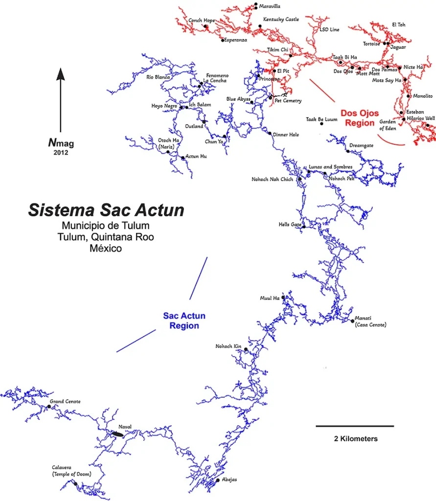
Cenote La Concha is part of the connected system Sac Actun-Nohoch-Dos Ojos. Moreover, it is the world’s second-largest underwater cave system, with 376,7 km (234 miles) of underwater lines. The maximum depth is 119.18 mts (391 ft). The Nohoch historical section is an anchialine cave system connecting to naturally intruding marine water and tidal influence in the cenotes. However, this cave system’s coastal discharge point(s) has not yet been explored into the ocean. Despite this, dye tracing to flow towards Caleta Xel-Ha, a nearby coastal bedrock lagoon, demonstrated large volumes of groundwater.
The next world’s longest cave system, Ox Bel Ha, is very close — just a few kilometers south. So, perhaps shortly, a place will be discovered where these two cave systems connect. The combined cave system will be the largest underwater cave system in the world and the largest cave system in general, including dry caves.
Cenote dives in this area are available to certified cave divers who can go alone or are guided by a qualified cave instructor.
La Concha cenote
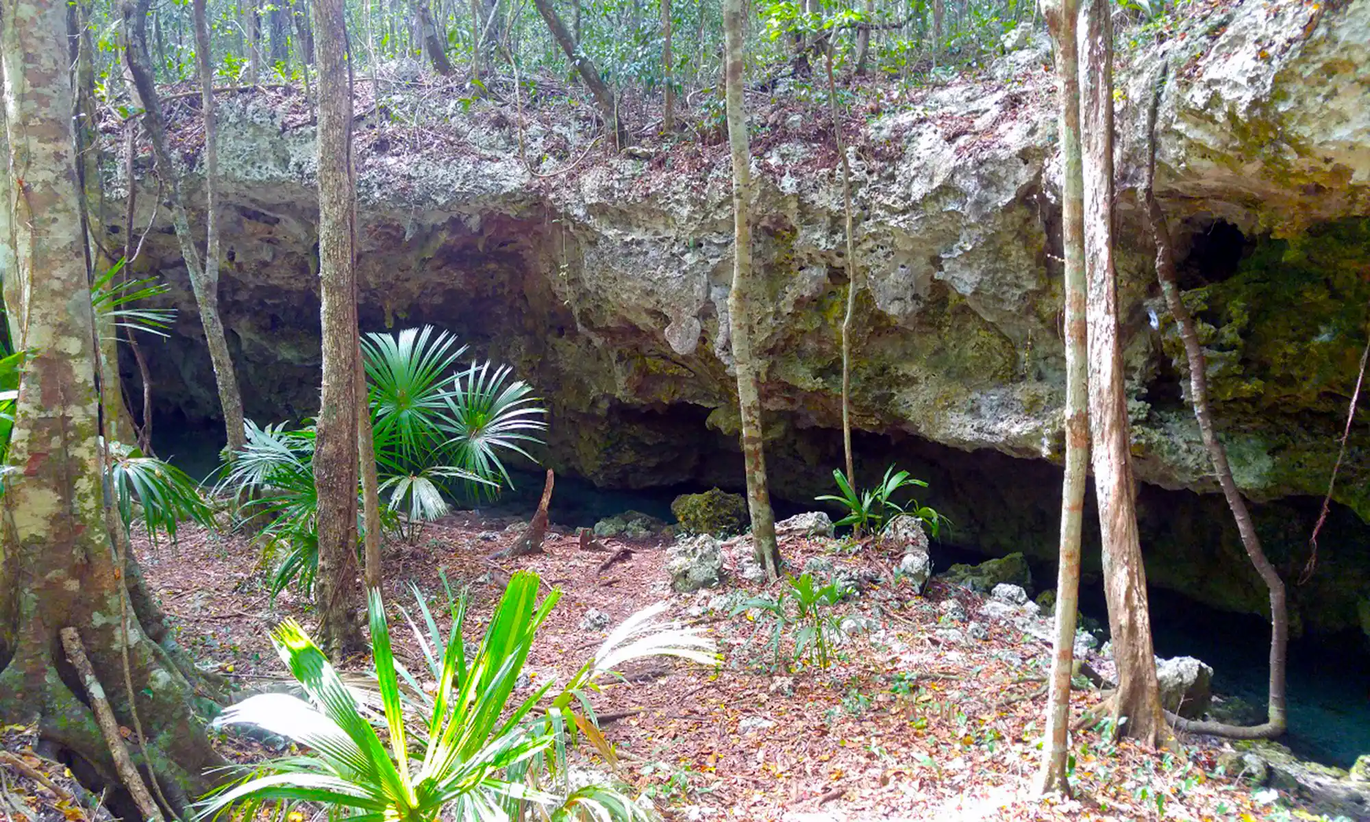
Farther away in the forest, an 8km potholed dirt road leads to the La Concha Cenote. La Concha is one more half-collapsed sinkhole. Together with other nearby cenotes, it was part of the Actun Hu (don’t mess with Actun Ha) cave system, which now belongs to the Sac Actun-Nohoch-Dos Ojos cave system. Furthermore, the jungle atmosphere was overwhelming. Entry to the water was very shallow over white sand. Outside the cave were tall leafy trees, and beautiful “mot-mot” birds flew by.
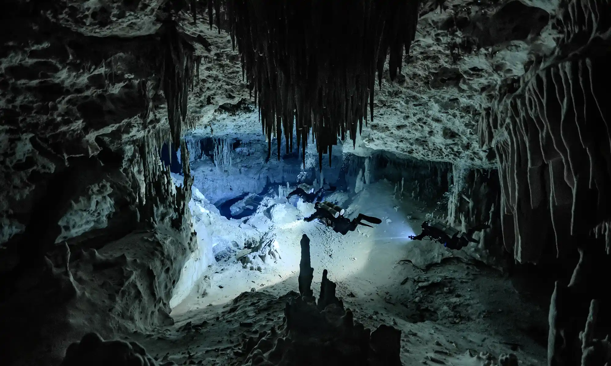
Sneaking through a narrow gateway in the limestone, you immediately plummeted to a depth of 10m for the rest of the dive. Visibility is always clear. You can turn left and right at the first T-junction of the permanent guideline. Soon after, you meander through various chambers of the La Concha Cenote, which have columns, stalagmites, stalactites, and helictites hanging from the roof like darts.
Following the narrow jungle trail back to the car, you can notice with awe a tiny snake coiled neatly on top of a white rock. The cuatro narices, or ultimate pit viper (Bothrops asper), is one of the most poisonous snakes of Yucatán. Also known as fer-de-lance, it can spit venom at a distance of two meters.
Our La Concha Cenote cave diving video

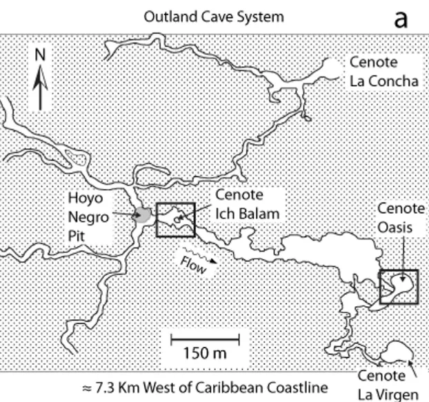
La Concha – Outland – Ich Balam cenotes situation map
La Concha – Fenomeno cenotes situation map
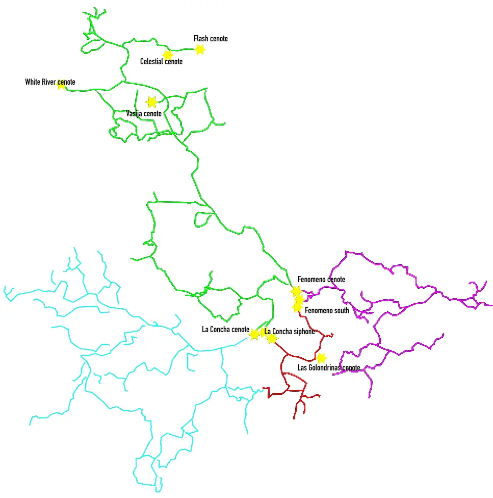
This map was published courtesy of OnlyCenotes.
La Concha cenote upstream area lines map
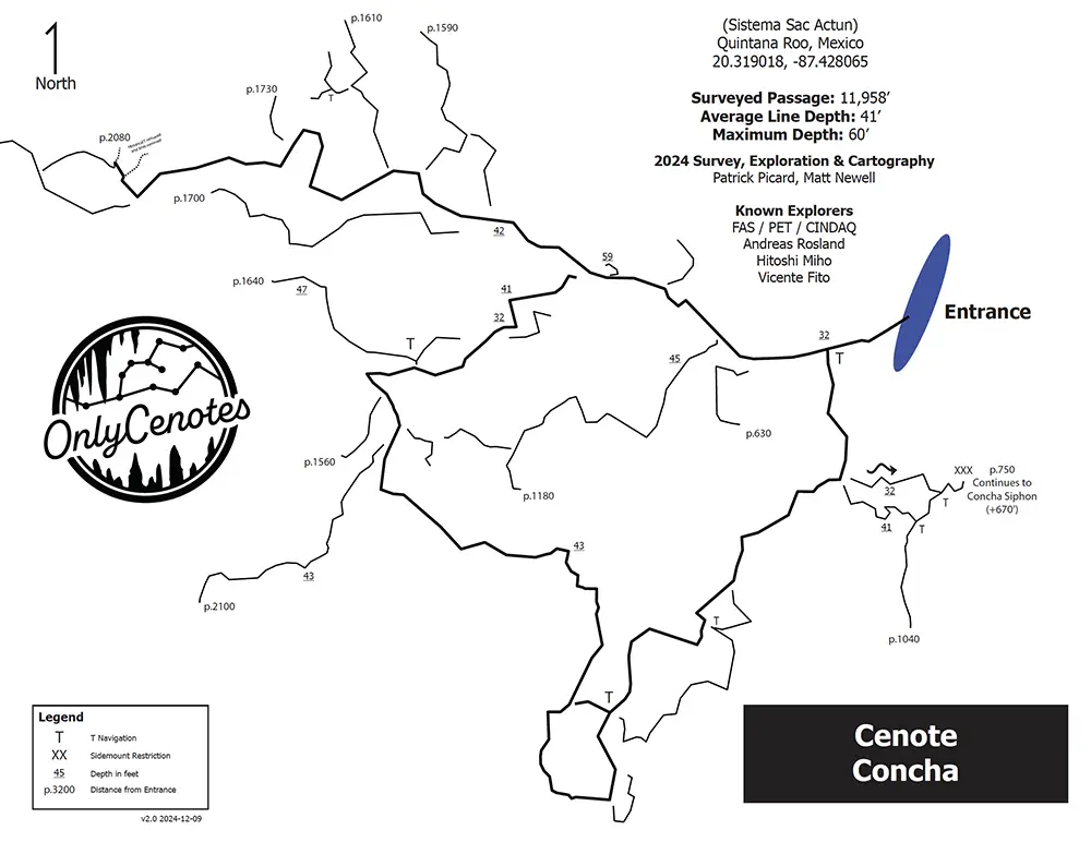
This map was published courtesy of OnlyCenotes.
Concha Siphon – Fenomeno South cenotes area lines map
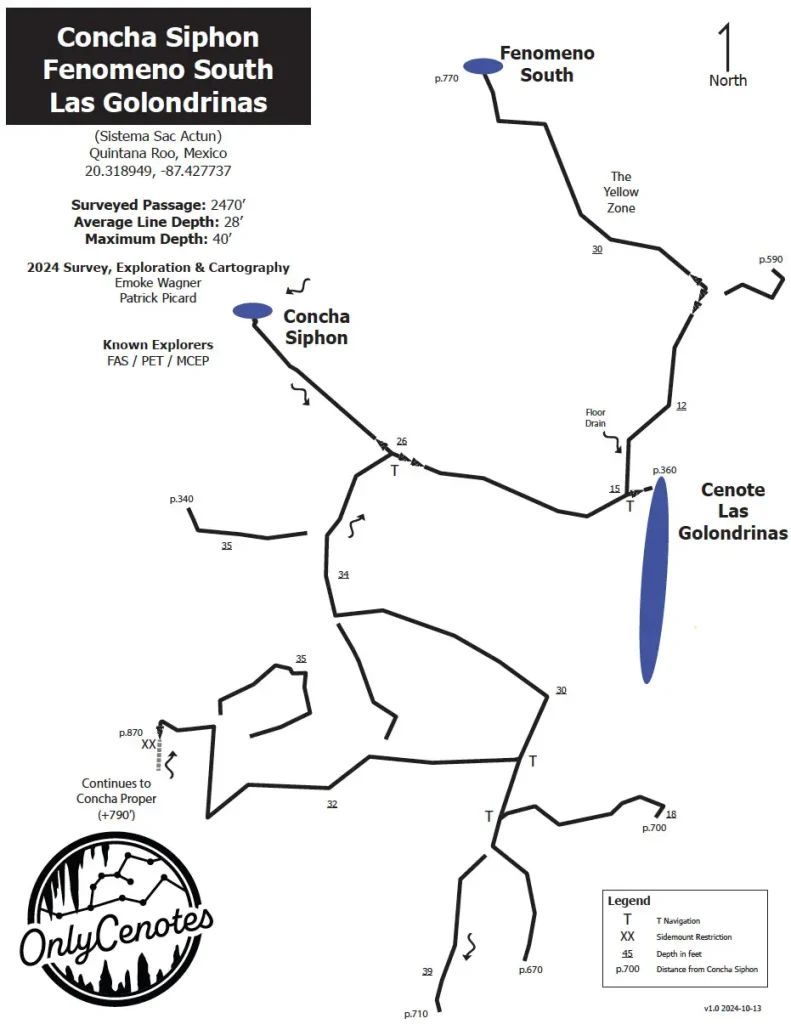
This map was published courtesy of OnlyCenotes.
La Concha Cenote location map
The first explorers were PET members Alex Alvarez, Franco Attolini, and Alberto Nava, who joined forces with MCEP/CINDAQ members Chris Le Maillot, Daniel Riordan, Fred Devos, and Sam Meacham to explore the Aktun Hu Cave System.
Explorations in Sistema Actun Hu began in January 2007. Explorers focused on La Concha and upstream Cenote Chicomoztoc. About 8,000 ft (2,438 m) of passages were explored and surveyed, and a new, large cenote was located southeast of La Concha.
Robbie Schmittner connected Sistema Aktun Hu to the Nohoch Nah Chich region of Sistema Sac Actun on January 30, 2011
Back