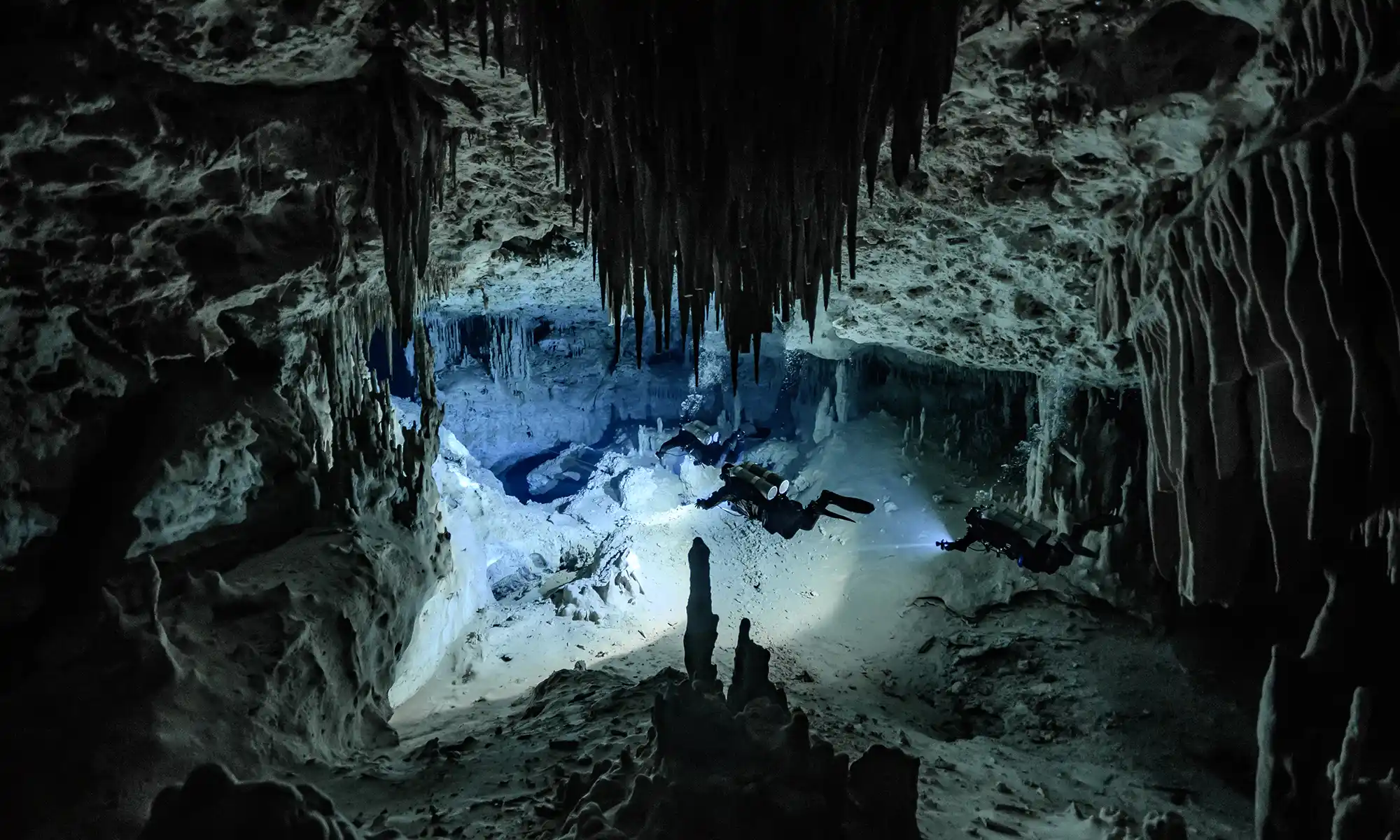
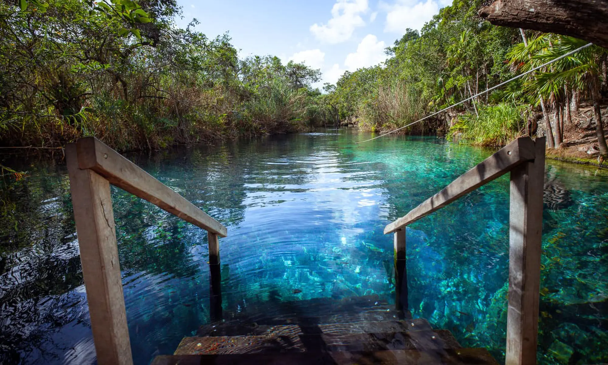
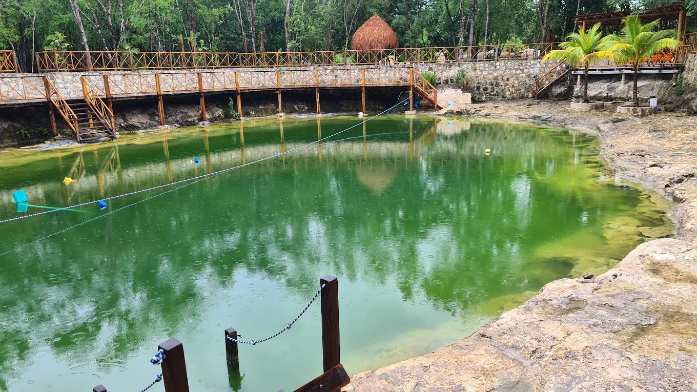
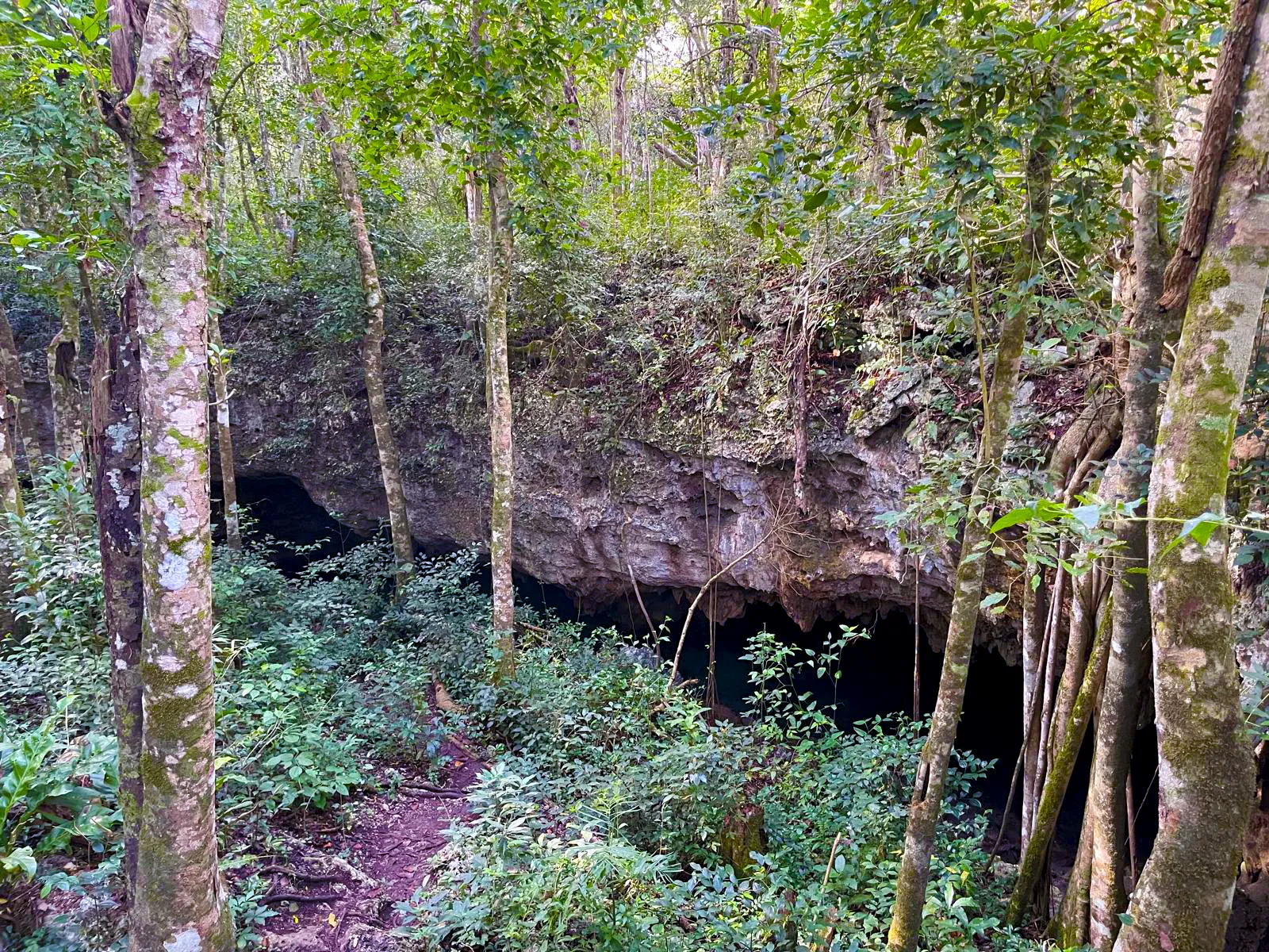
The enigmatic Mayan Blue (Escondido) Cenote or Cave, a jewel in the crown of the World’s Longest Underwater Cave, the Ox Bel Ha Cave System (‘Three Paths of Water’), is a sight to behold.
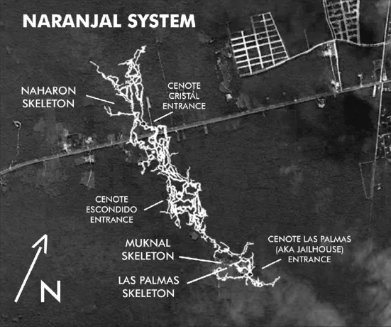
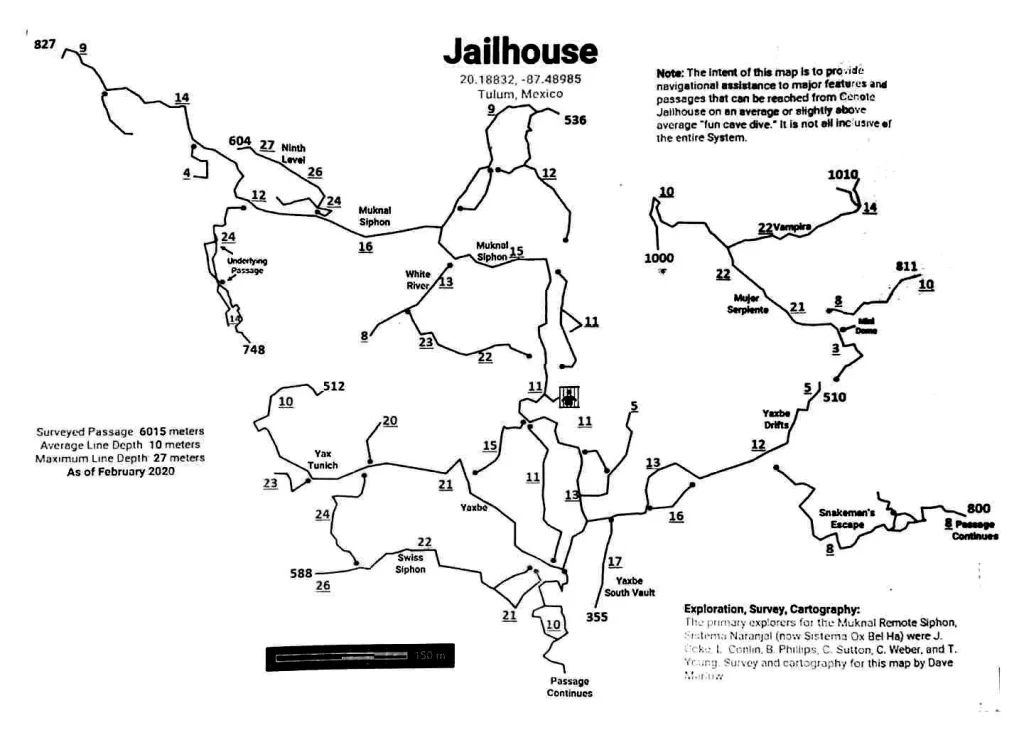
Historically, the Mayan Blue (Escondido) Cenote, the Jailhouse Cenote, and the Naharon Cenote were part of the Naranjal Cave system. On the weekend of March 28, 2011, Steve Bogearts of Playa del Carmen connected Sistema Naranjal to Sistema Ox Bel Ha. Support cave diver Bil Philips of Tulum assisted with logistics.
Nestled south of Tulum and near the captivating Sian Ka’an Biosphere Reserve, the Ox Bel Ha cave system unveiled its mysteries in 1996 when a team of cave divers embarked on its discovery and exploration.
Ox Bel Ha Cave System from January 2023 (thanks to CINDAQ team efforts) becomes again the World’s Longest Underwater Cave. It boasts an impressive length of 496.8 kilometers (308.6 mi), securing its status as the world’s longest underwater cave system. As of the end of 2023, the cave system encompassed 160+ cenotes. The most notable ones are cenote Jailhouse, cenote Naharon, cenote Escondido (Mayan Blue). According to the latest CINDAQ annual report, the system includes 56674 survey stations, 615 sections, more than 2500 jumps, 1500+ T intersections, and 7683 cave line markers.
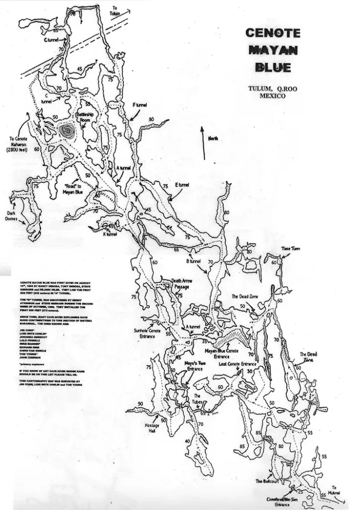
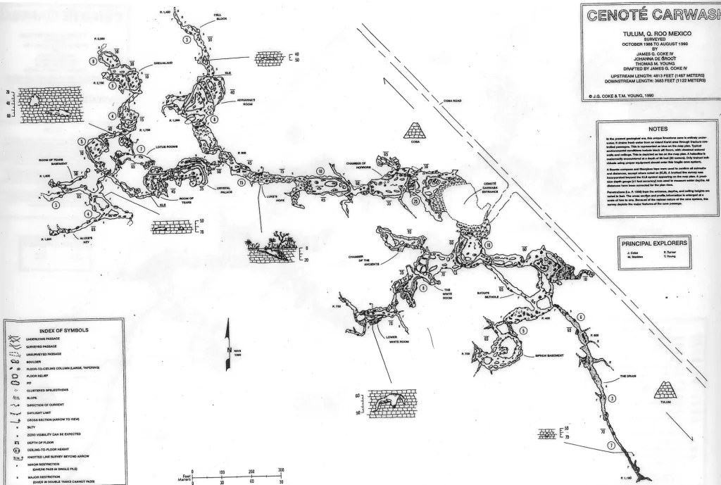
Ox Bel Ha Cave System map
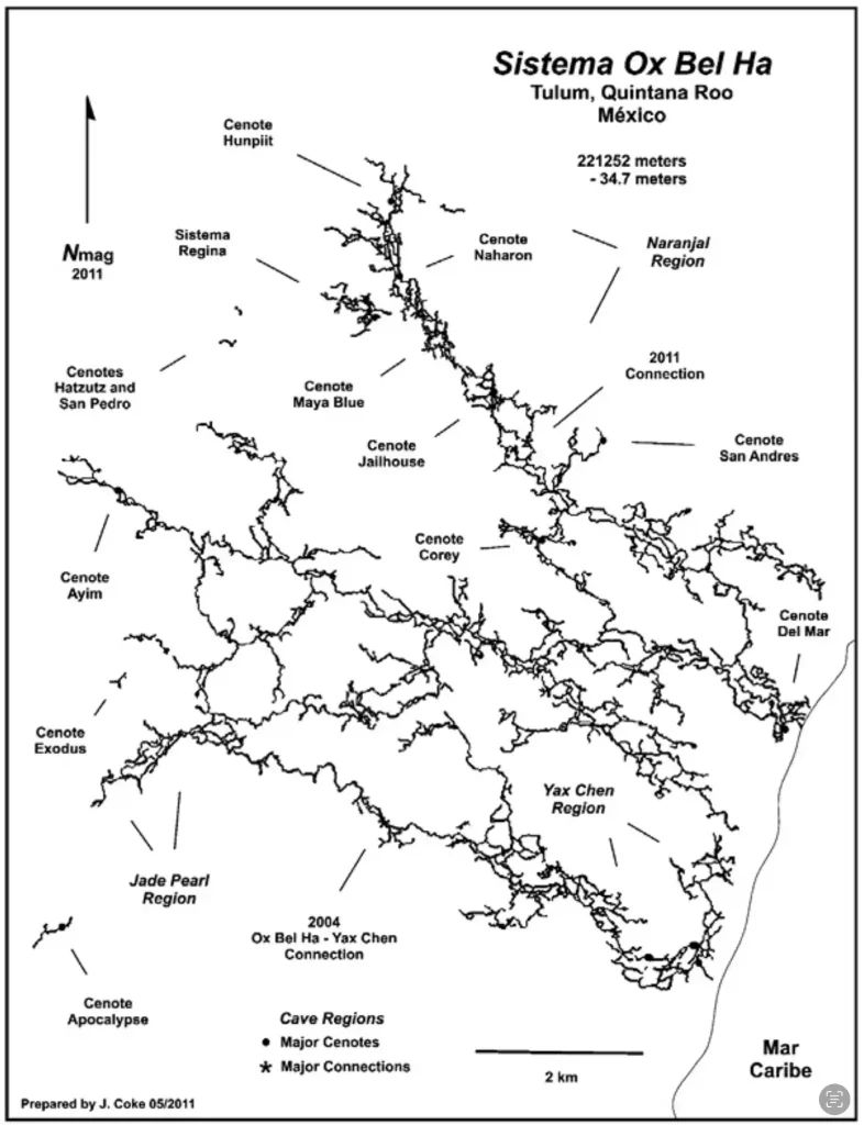
The name “Ox Bel Ha,” derived from the Mayan language, translates to “Three Paths of Water,” eloquently capturing the intricate nature of this geological marvel.
The Yucatan Peninsula’s distinctive geological history, a testament to the Earth’s transformative power over millions of years, has given rise to a sprawling labyrinth of underground passages and cenotes. This unique geological formation, a gift to cave divers and geology enthusiasts, has established the Ox Bel Ha cave system as a paradise to explore and admire.
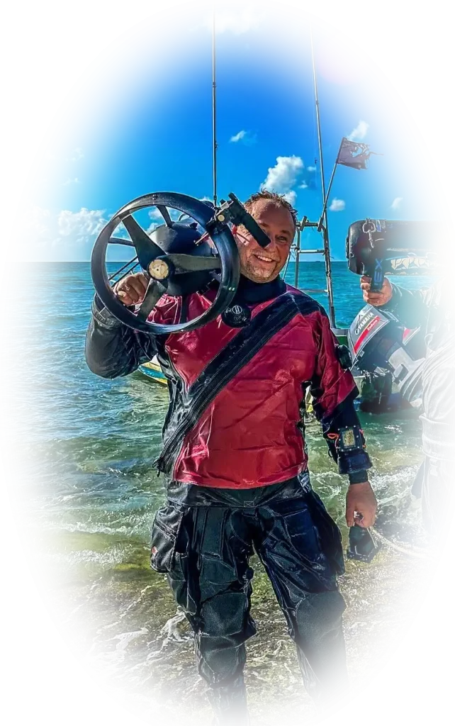
Cenote Mayan Blue
This cave area would be considered one the most outstanding in the Riviera Maya if not for all the tannic-stained walls and decorations above the halocline at 60 ft (18.3 m). This tannic acid intrudes into the aquifer from a huge swamp area 8 km west of Nahaton Cenote into the jungle. Within geological time (thousands of years), the tannic acid stains the calcium carbonate into a dark brown. Because everything is so dark, the cave divers’ light is absorbed. The few saltwater areas are not affected as the calcium carbonate is bleached by the saltwater.
The best cave dives are the B, E, and F tunnels, mostly saltwater. Enter the B tunnel and follow the line for 800 ft (244 m). There will be two directional arrows; jump to your right, about 35 ft (10.7 m), to the E line. Follow this line.
There is the A tunnel with a gold line to the Battleship Room and beyond, which is fresh and saltwater. Moving further, you will reach Cenote Naharon within 3 jumps, all to the right.
The traverse dive (two different ways) to the Cenote Sun is downstream. If you wanna go further, go to the left at the T. After a while, you will reach the Mukhal Siphone area of the Jailhouse Cenote.
Our Mayan Blue Cenote cave diving video

CREER Mayan Blue Cenote Cave Line Marking Trial Project
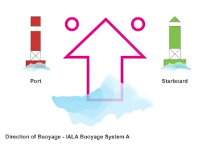
The color coding system used in the trial depended on available arrow colors and is the same as that used by Bil Phillips at Caracol. The red and green system comes from the colors of buoys in the IALA (International Association of Marine Aids to Navigation and Lighthouse Authorities) system A, which corresponds to the colors of navigation lights on small boats that many divers will be familiar with.
- The arrows marked with the name of the passage and the distance to the exit they are pointing to;
- Jumps on the right marked by green arrows, and jumps on the left have red arrows;
- Arrows at the start of jump lines white and marked with the name of the line;
- Arrows that do not correspond to a jump white and marked with distance.
Cenote Mayan Blue cave lines map
Mayan Blue Cenote location map
The first explorers were Nancy and Tony DeRosa and Steve Gerrard. Hilario Hiler explored the A tunnel in August 1986. Steve Penn and Denny Atkinson explored the B tunnel in October 1986.
Other explorers were Jim Coke, Lori Beth Conlin, Johanna DeGroot, Paul Heinerth, Dan Lins, Mike Madden, Parker Turner, Harve and Toni Thorne, Tom Young, and Chris Van Winkle.
Back